Mjuken
| Mjuken | |
|---|---|
| Nuken | |
|
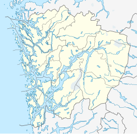
Location in Hordaland
|
|
| Highest point | |
| Elevation | 57 m (187 ft) |
| Coordinates | 60°08′15″N 05°04′29″E / 60.13750°N 5.07472°ECoordinates: 60°08′15″N 05°04′29″E / 60.13750°N 5.07472°E |
| Geography | |
| Location | Hordaland, Norway |
Mjuken or Nuken is a hill on the island of Stora Kalsøy in the municipality of Austevoll in Hordaland county, Norway. The 57-metre (187 ft) tall hill sits in a rocky and mountainous area of the island and this particular peak is the highest point on the island. The village of Bakkasund lies south of the hill.
...
Wikipedia

