Mitzpe Yericho
|
Mitzpe Yeriho מִצְפֵּה יְרִחוֹ |
|
|---|---|
 |
|
| Coordinates: 31°48′57.60″N 35°23′38.76″E / 31.8160000°N 35.3941000°ECoordinates: 31°48′57.60″N 35°23′38.76″E / 31.8160000°N 35.3941000°E | |
| District | Judea and Samaria Area |
| Council | Mateh Binyamin |
| Region | West Bank |
| Affiliation | Amana |
| Founded | October 1977 |
| Population (2015) | 2,307 |
| Name meaning | Jericho lookout |
| Website | Official website |
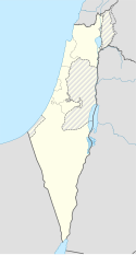
Mitzpe Yeriho (also spelled “Mitzpeh Yericho”) (Hebrew: מִצְפֵּה יְרִיחוֹ, lit. Jericho Lookout) is a religious Israeli settlement in the Judaean Desert. Located 20 km east of Jerusalem and 10 km east of Ma'ale Adummim along Highway 1 in the Judean desert, it is organised as a community settlement and falls under the jurisdiction of Mateh Binyamin Regional Council. In 2015 it had a population of 2,307.
The village lies on one of the last cliffs marking the edge of the Judean highlands, and overlooks the Jordan Rift Valley, the Dead Sea, and the ancient city of Jericho whence its name is derived. The climate is dry, with temperatures a few degrees warmer than Jerusalem temperatures all year round.
Founded in October 1977 during the Jewish holiday of Sukkot, it was supposed to be located on government lands adjacent to Jericho. Due to the objection of then Defense Minister Ezer Weizman, they were moved to Mishor Adumim. Agriculture Minister Ariel Sharon suggested a few days later that they relocate to a barren hilltop overlooking Jericho, its current location.
...
Wikipedia

