Mitre Peak (New Zealand)
| Mitre Peak | |
|---|---|

Mitre Peak, Milford Sound
|
|
| Highest point | |
| Elevation | 1,690 m (5,540 ft) |
| Parent peak | Aoraki / Mount Cook |
| Coordinates | 44°38′S 167°51′E / 44.633°S 167.850°ECoordinates: 44°38′S 167°51′E / 44.633°S 167.850°E |
| Geography | |
|
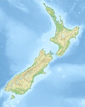
South Island, New Zealand
|
|
Mitre Peak (Māori Rahotu) is an iconic mountain in the South Island of New Zealand, located on the shore of Milford Sound. It is one of the most photographed peaks in the country.
The distinctive shape of the peak in southern New Zealand gives the mountain its name, after the mitre headwear of Christian bishops. It was named by Captain John Lort Stokes of the HMS Acheron. The Māori name for the peak is Rahotu.
Part of the reason for its iconic status is its location. Close to the shore of Milford Sound, in the Fiordland National Park in the southwestern South Island, it is a stunning sight. The mountain rises near vertically to 5,560 feet (1,690 m), i.e. just over a mile, from the water of the sound; it is more technically a fjord. The peak is actually a closely grouped set of five peaks, although from most easily accessible viewpoints it appears as a single point. Milford Sound is part of Te Wahipounamu, a World Heritage Site as declared by UNESCO.
The only road access to Milford Sound is via State Highway 94, in itself one of the most scenic roads in New Zealand.
Mitre Peak is difficult to climb and not many people do so. The first attempt was made in 1883, but was aborted due to bad weather. The next attempt on 13 March 1911 by J R Dennistoun from Peel Forest. People did not believe Dennistoun, who claimed to have built a cairn on the peak to which he had fixed his handkerchief. Those facts were confirmed by the next successful climbers in 1914. There are six routes up to Mitre Peak, and most climbers start by getting a boat to Sinbad Bay.
...
Wikipedia

