Minsener Oog

Minsener Oog
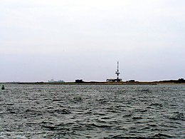
seen from the mainland to the south |
|
| Geography | |
|---|---|
| Location | North Sea |
| Coordinates | 53°45′47″N 8°0′48″E / 53.76306°N 8.01333°ECoordinates: 53°45′47″N 8°0′48″E / 53.76306°N 8.01333°E |
| Archipelago | East Frisian Islands |
| Area | 3.7 km2 (1.4 sq mi) |
| Length | 4.5 km (2.8 mi) |
| Width | 1.5 km (0.93 mi) |
| Highest elevation | 12 m (39 ft) |
| Administration | |
|
Germany
|
|
| Demographics | |
| Population | 0 |

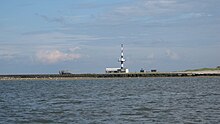
Minsener Oog Buhne C Lighthouse
|
|
|
Lower Saxony
|
|
| Coordinates | 53°45′20″N 8°01′19″E / 53.755681°N 8.022015°E |
|---|---|
| Year first constructed | 1976 |
| Deactivated | 1998 |
| Construction | concrete tower |
| Tower shape | cylindrical tower with a communications and radar tower on the summit |
| Markings / pattern | tower with white and black horizontal bands |
| Height | 53 metres (174 ft) |
| Focal height | 25 metres (82 ft) |
| Characteristic | Fl WGR 4s. |
| Admiralty number | B1128 |
| ARLHS number | FED-013 |
Minsener Oog, also Minser Oog or Minsener Oldeoog, is an uninhabited East Frisian island that belongs to the parish of Wangerooge in the north German district of Friesland in the state of Lower Saxony. It has been artificially enlarged through the construction of groynes.
The island is located just two kilometres southeast of the island of Wangerooge, from which it is separated by the creek of Blaue Balje, and four kilometres north of the mainland. The nearest towns on the mainland are Minsen and Schillig. The island's landowner is the Wilhelmshaven Water and Shipping Authority (Wasser- und Schifffahrtsamt Wilhelmshaven or WSA).
The name of the isle comes from the village of Minsen which lies opposite it on the mainland. There is a legend that Minsen was originally established on the island of Minsener Oog. The fishermen of the village caught a mermaid with the lower body of a fish, which then had the village drowned by a flood in revenge. Although this tradition is historically extremely doubtful, there is in Minsen a bronze sculpture of the Minsen Seewiefken, which is also the emblem on the coat of arms for the parish of Wangerland.
Minsener Oog was formed from the Minsener Oog sandbanks and the Olde Oog or Steen Plate sandbank, 200 to 300 metres to the south. In 1906 the Wilhelmshaven Marine Construction Authority erected groynes and embankments on the Olde Oog and dams to prevent the channel of the River Jade from silting up. This was intended to keep the channel to Wilhelmshaven clear of sand drifting from east to west, especially for the fleet of the German Imperial Navy. On the original 7 km2sand bank of Olde Oog there was a small area of dunes, as on Minsener Oog. By building long connecting groynes the sand was held back and formed a "fore-dune" which quickly established itself as a breeding ground for seabirds.
...
Wikipedia

