Minidoka National Wildlife Refuge
| Minidoka National Wildlife Refuge | |
|---|---|
|
IUCN category IV (habitat/species management area)
|
|

Minidoka National Wildlife Refuge
|
|
|
Map of the United States
|
|
| Location | Blaine County, Cassia County, Minidoka County, Power County, Idaho, United States |
| Nearest city | Rupert, Idaho |
| Coordinates | 42°40′13″N 113°23′22″W / 42.67018°N 113.38944°WCoordinates: 42°40′13″N 113°23′22″W / 42.67018°N 113.38944°W |
| Area | 20,751 acres (83.98 km2) |
| Established | 1909 |
| Governing body | U.S. Fish and Wildlife Service |
| Website | Minidoka National Wildlife Refuge |
Minidoka National Wildlife Refuge is located on the Snake River Plain in south-central Idaho, 12 miles (19 km) northeast of Rupert. It includes about 80 miles (130 km) of shoreline around Lake Walcott, from Minidoka Dam upstream about 25 miles (40 km).
Mule deer are commonly seen near the headquarters. Pronghorn roam in the open sagebrush areas in this refuge. Other mammal species including beaver, cottontail rabbit, porcupine, raccoon, coyote, thirteen species of bats, as well as other mammals are present in this refuge. Less common mammal species include cougar, bobcat, river otter, elk and moose.
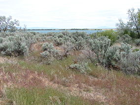
About half of the refuge's acreage is open water and wetlands. In this arid landscape, these resources serve as an oasis drawing numerous wildlife species from miles around. Many species use the bulrush and cattail habitat that lines the lake's small bays. Others use the willows, cottonwoods and other trees growing near shorelines. The rest of the refuge is low, rolling uplands covered by sagebrush, grasses, and isolated juniper patches among scattered outcrops of basalt. The refuge has a surface area of 20,751 acres (83.98 km2).
...
Wikipedia

