Midway, Derbyshire
Swadlincote
|
|
|---|---|
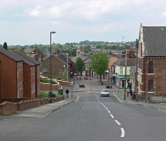
 Hill Street looking towards High Street, Swadlincote's main shopping street |
|
| Swadlincote shown within Derbyshire | |
| Population | 32,219 (2011) |
| OS grid reference | SK2919 |
| Civil parish |
|
| District | |
| Shire county | |
| Region | |
| Country | England |
| Sovereign state | United Kingdom |
| Post town | Swadlincote |
| Postcode district | DE11 |
| Dialling code | 01283 |
| Police | Derbyshire |
| Fire | Derbyshire |
| Ambulance | East Midlands |
| EU Parliament | East Midlands |
| UK Parliament | |
Swadlincote is a town in Derbyshire, England, close to the borders with Leicestershire and Staffordshire. It is located approximately 5 miles (8 km) southeast of Burton-upon-Trent, 5 miles (8 km) northwest of Ashby-de-la-Zouch and 12.5 miles (20 km) due south of Derby. It is an unparished area in the South Derbyshire district, of which it is the largest town and administrative centre.
Swadlincote consists of the settlements of Swadlincote itself plus the districts of Newhall and Midway, and the contiguous suburban villages of Church Gresley and Woodville. Their combined population is about 36,000. The village of Castle Gresley is situated less than 2 miles (3 km) to the southwest and the community of Albert Village lies 1.5 miles (2 km) to the south, just within Leicestershire.
Swadlincote's name is derived from the Old English Swartlings Cottas, Swartling being a man's name and cottas meaning cottages. Past forms of the name include Sivardingescote and Swartlincote. Swadlincote residents often shorten its name to "Swad".
The Domesday Book of 1086 recorded Swadlincote as a small manor. It was part of the parish of Gresley (latterly Church Gresley) until the 19th century.
The first record of mineral extraction in the area is from the end of the 13th century, but the area remained rural until the industrialisation in the 18th century. The presence of coal and clay in the area led to urbanisation as collieries, brickworks and potteries came to dominate Swadlincote. These industries continued to expand until the Second World War. In Alexandra Road one traditional bottle-shaped kiln survives. The fireclay strata in the coal measures has a high alumina content. Swadlincote is one of only six places in Great Britain with clay deposits of such quality. The high alumina content makes it particularly suitable for salt glazing. The properties of the clay mean that it is easily formed into pipes that are resistant to sewage. The Public Health Act 1875 created a huge demand for locally produced pipes.
...
Wikipedia

