Middleton, Tennessee
| Middleton, Tennessee | |
|---|---|
| City | |
| Motto: Crossroads of the South | |
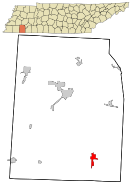
 Location in Hardeman County and the state of Tennessee. |
|
| Coordinates: 35°3′32″N 88°53′30″W / 35.05889°N 88.89167°WCoordinates: 35°3′32″N 88°53′30″W / 35.05889°N 88.89167°W | |
| Country | United States |
| State | Tennessee |
| County | Hardeman |
| Chartered | 1850 |
| Government | |
| • Mayor | Vernon Henderson |
| • Vice Mayor | Bill Sain |
| Area | |
| • Total | 1.9 sq mi (4.8 km2) |
| • Land | 1.8 sq mi (4.8 km2) |
| • Water | 0.0 sq mi (0.0 km2) |
| Elevation | 417 ft (127 m) |
| Population (2000) | |
| • Total | 602 |
| • Density | 326.3/sq mi (126.0/km2) |
| Time zone | Central (CST) (UTC-6) |
| • Summer (DST) | CDT (UTC-5) |
| ZIP code | 38052 |
| Area code(s) | 731 |
| FIPS code | 47-48340 |
| GNIS feature ID | 1293713 |
| Website | http://cityofmiddleton.org/default.aspx |
Middleton is a city in Hardeman County, Tennessee. The population was 602 at the 2000 census. It is located at the intersection of Tennessee State Route 125 and Tennessee State Route 57. Its slogan is the "Crossroads of the South".
It is believed that early settlers in Middleton came from Slab Town, a small settlement about three miles north. The town was originally called Jenkins-McCommons Crossing, after Jesse Jenksins and William Taylor McCommons. These two men came to the area from North Carolina in 1849 and donated the majority of land where Middleton is today. Following the expansion of the Memphis and Charleston Railroad and the construction of a railroad depot, Middleton was chartered in 1850. It was named after an official at the Memphis and Charleston Railroad. The town would suffer greatly during the Civil War. After the war, only one building, a small log structure that served as a store, was left standing.
Middleton is located at 35°3′32″N 88°53′30″W / 35.05889°N 88.89167°W (35.058798, -88.891728).
According to the United States Census Bureau, the city has a total area of 1.9 square miles (4.9 km2), of which 1.8 square miles (4.7 km2) is land and 0.54% is water.
As of the census of 2000, there were 602 people, 259 households, and 171 families residing in the city. The population density was 326.3 people per square mile (126.3/km²). There were 289 housing units at an average density of 156.7 per square mile (60.6/km²). The racial makeup of the city was 87.87% White, 11.30% African American, 0.66% Asian, and 0.17% from two or more races. Hispanic or Latino of any race were 0.66% of the population.
...
Wikipedia
