Meyrin
| Meyrin | ||
|---|---|---|

Meyrin village church and square
|
||
|
||
| Coordinates: 46°13′N 06°04′E / 46.217°N 6.067°ECoordinates: 46°13′N 06°04′E / 46.217°N 6.067°E | ||
| Country | Switzerland | |
| Canton | Geneva | |
| District | n.a. | |
| Government | ||
| • Mayor |
Maire Nathalie Leuenberger SPS/PSS (as of 2016) |
|
| Area | ||
| • Total | 9.94 km2 (3.84 sq mi) | |
| Elevation | 446 m (1,463 ft) | |
| Population (Dec 2015) | ||
| • Total | 22,152 | |
| • Density | 2,200/km2 (5,800/sq mi) | |
| Postal code | 1217 | |
| SFOS number | 6630 | |
| Surrounded by | Ferney-Voltaire (FR-01), Grand-Saconnex, Prévessin-Moëns (FR-01), Satigny, Vernier | |
| Website |
www SFSO statistics |
|
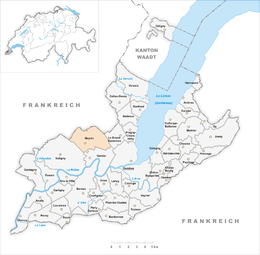
Meyrin (French pronunciation: [mɛʁɛ̃]) is a municipality of the Canton of Geneva, Switzerland.
The main site of the CERN particle physics laboratory is in Meyrin. Meyrin was originally a small agricultural village until the 1950s, when construction of CERN began just to the north. It is now a commuter town dominated with apartment high-rises, and many of its residents work at CERN or in central Geneva.
Geneva International Airport is partially located in Meyrin.
Meyrin is first mentioned in 1153 as Mairin.
Meyrin has an area, as of 2009[update], of 9.94 square kilometers (3.84 sq mi). Of this area, 3.54 km2 (1.37 sq mi) or 35.6% is used for agricultural purposes, while 0.43 km2 (0.17 sq mi) or 4.3% is forested. Of the rest of the land, 5.87 km2 (2.27 sq mi) or 59.1% is settled (buildings or roads), 0.01 km2 (2.5 acres) or 0.1% is either rivers or lakes and 0.08 km2 (20 acres) or 0.8% is unproductive land.
Of the built up area, industrial buildings made up 11.1% of the total area while housing and buildings made up 17.7% and transportation infrastructure made up 25.8%. while parks, green belts and sports fields made up 3.5%. Out of the forested land, all of the forested land area is covered with heavy forests. Of the agricultural land, 28.5% is used for growing crops and 4.8% is pastures, while 2.3% is used for orchards or vine crops. All the water in the municipality is in lakes.
The municipality is located on the right bank of the Rhone river and consists of the sub-sections or villages of CERN, Maisonnex, Mategnin, Citadelle, Aéroport - Tour-de-Contrôle, Aéroport - Papillons, Aéroport - Forestier, Cointrin - Les Sapins, Cointrin - Les Ailes, Cointrin - Pré-Bois, ZI Riantbosson.
Meyrin has a population (as of December 2015[update]) of 22,152. As of 2008[update], 41.5% of the population are resident foreign nationals. Over the last 10 years (1999–2009 ) the population has changed at a rate of 13.7%. It has changed at a rate of 7.5% due to migration and at a rate of 6.3% due to births and deaths.
...
Wikipedia


