Mersey Island
| Mersea Island | |
|---|---|
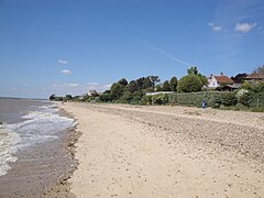
 West Mersea beach |
|
|
Mersea Island shown within Essex
|
|
| Population | 6,925 |
| OS grid reference | TM060150 |
| Civil parish | |
| District | |
| Shire county | |
| Region | |
| Country | England |
| Sovereign state | United Kingdom |
| Post town | Colchester |
| Postcode district | CO5 8 |
| Dialling code | 01206 |
| Police | Essex |
| Fire | Essex |
| Ambulance | East of England |
| EU Parliament | East of England |
| UK Parliament | |
Mersea Island /ˈmɜːrzi/ is an island in Essex, England, in the Blackwater and Colne estuaries to the south-east of Colchester. Its name comes from the Old English word meresig, meaning "island of the pool". The island is split into two main areas, West Mersea and East Mersea, and connected to the mainland by the Strood, a causeway that can flood at high tide.
The island has been inhabited since pre-Roman times. It was used as a holiday destination in Roman Britain for occupants of Camulodunum (Colchester). Fishing has been a key industry on the island since then, particularly oysters, and along with tourism makes up a significant part of the island's economy. The Church of St Peter & St Paul in West Mersea is thought to have existed since the 7th century, while the Church of St Edmund in East Mersea dates from around the 12th or 13th centuries. The island became popular with smugglers from the 16th to the 19th century. It became a focal point for troops in both world wars, and a number of observation posts can still be found on the island. Tourism remains popular, and there are a number of beach huts and holiday parks on the island. A week-long festival of boat racing, Mersea Week, takes place every summer.
The island lies 9 miles (14 km) south of Colchester and 26 miles (42 km) east of the county town, Chelmsford. It is the most easterly inhabited and publicly accessible island in the United Kingdom and is one of 43 (unbridged) tidal islands which can be accessed on foot or by road from the British mainland. It is situated in the estuary area of the Blackwater and Colne rivers and has an area of around 7 square miles (18 km2). It is formed by the Pyefleet Channel to the north and the Strood Channel to the west, which connect the Blackwater to the Colne. The much smaller Ray Island lies adjacent to the north while the uninhabited Packing Marsh and Cobmarsh Islands lie to southwest. Most of the area immediately surrounding the island consists of saltmarsh and mudflats, and is an important sanctuary for wading and migratory birds. The island itself sits on a mix of London Clay, chalky boulder clay, sand and gravel.
...
Wikipedia

