Menstrie
Menstrie
|
|
|---|---|
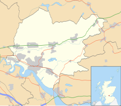
| Menstrie shown within Clackmannanshire | |
| Population | 2,640 |
| OS grid reference | NS852969 |
| Council area | |
| Lieutenancy area | |
| Country | Scotland |
| Sovereign state | United Kingdom |
| Post town | Menstrie |
| Postcode district | FK11 |
| Dialling code | +44 (0) 1259 |
| Police | Scottish |
| Fire | Scottish |
| Ambulance | Scottish |
| EU Parliament | Scotland |
| UK Parliament | |
| Scottish Parliament | |
Menstrie (Scottish Gaelic: Meanstraidh) is a village in the county of Clackmannanshire in Scotland. It is about 5 miles (8 kilometres) east-north-east of Stirling and is one of a string of towns that, because of their location at the base of the Ochil Hills, are collectively referred to as the Hillfoots Villages or simply The Hillfoots.
Menstrie stands on the carse or flood plain of the River Devon, between 10 and 20 metres altitude above sea level. It is roughly astride the Ochil Fault whose movement gave rise to the dramatic southern scarp of the Ochils but which is now almost quiescent.
Two of the most westerly summits of the Ochil Hills, Dumyat and Myreton Hill, rise steeply to the north of the village to reach about 400m altitude. These two hills are divided by Menstrie Glen, from which the small watercourse of Menstrie Burn emerges and runs through the village. About a kilometre to the south of Menstrie, the burn joins the River Devon which in turn meets the River Forth at Cambus.
The Menstrie Burn, though generally tranquil, drains a catchment area (Menstrie Glen) of about 14 km2 in the Ochil Hills and occasionally experiences flash floods. On 29 August 2012, the burn overflowed its banks and 38 elderly residents of Menstrie House had to be evacuated to other care homes within the region. No-one was hurt. The Community Centre and some nearby roads and houses were also flooded though no residents needed evacuation. The A91 road was closed for some hours while structural engineers checked the integrity of the bridges over the burn. Clackmannanshire Council commissioned a consultants' report on the flood event and has made the summary available to the public in PDF format.
...
Wikipedia

