Memorial Field Airport
| Memorial Field Airport | |||||||||||||||
|---|---|---|---|---|---|---|---|---|---|---|---|---|---|---|---|
| Summary | |||||||||||||||
| Airport type | Public | ||||||||||||||
| Owner | City of Hot Springs | ||||||||||||||
| Serves | Hot Springs, Arkansas | ||||||||||||||
| Elevation AMSL | 540 ft / 165 m | ||||||||||||||
| Coordinates | 34°28′41″N 093°05′46″W / 34.47806°N 93.09611°WCoordinates: 34°28′41″N 093°05′46″W / 34.47806°N 93.09611°W | ||||||||||||||
| Website | HotSpringsAirport.net | ||||||||||||||
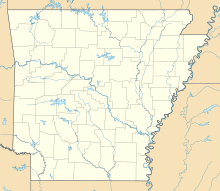
| Map | |||||||||||||||
| Location of airport in Arkansas / United States | |||||||||||||||
| Runways | |||||||||||||||
|
|||||||||||||||
| Statistics (2010) | |||||||||||||||
|
|||||||||||||||
|
Source: FAA and airport web site
|
|||||||||||||||
| Aircraft operations | 28,170 |
|---|---|
| Based aircraft | 122 |
Memorial Field Airport (IATA: HOT, ICAO: KHOT, FAA LID: HOT) is three miles southwest of the City of Hot Springs, in Garland County, Arkansas. It serves nearby Hot Springs National Park. The airport is used for general aviation; airline flights are subsidized by the federal government's Essential Air Service program at a cost of $1,637,012(per year). Fifteen retired Atlantic Southeast Airlines (ASA, which now operates as ExpressJet) Embraer 120 "Brasilia" twin turboprop aircraft are stored here.
Federal Aviation Administration records say the airport had 1,382 passenger boardings (enplanements) in calendar year 2008, 165 in 2009 and 799 in 2010. The National Plan of Integrated Airport Systems for 2011–2015 categorized it as a general aviation airport (the commercial service category requires at least 2,500 enplanements per year).
Memorial Field covers 844 acres (342 ha) at an elevation of 540 feet (165 m). It has two asphalt runways: 5/23 is 6,595 by 150 feet (2,010 x 46 m) and 13/31 is 4,099 by 100 feet (1,249 x 30 m). The airport is non-towered (the existing tower is no longer staffed).
...
Wikipedia


