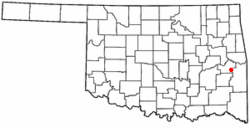
McCurtain, Oklahoma
| McCurtain, Oklahoma | |
|---|---|
| Town | |
 Location of McCurtain, Oklahoma |
|
| Coordinates: 35°9′1″N 94°58′17″W / 35.15028°N 94.97139°WCoordinates: 35°9′1″N 94°58′17″W / 35.15028°N 94.97139°W | |
| Country | United States |
| State | Oklahoma |
| County | Haskell |
| Area | |
| • Total | 1.1 sq mi (2.9 km2) |
| • Land | 1.1 sq mi (2.9 km2) |
| • Water | 0.0 sq mi (0.0 km2) |
| Elevation | 581 ft (177 m) |
| Population (2010) | |
| • Total | 516 |
| • Density | 469.1/sq mi (177.9/km2) |
| Time zone | Central (CST) (UTC-6) |
| • Summer (DST) | CDT (UTC-5) |
| ZIP code | 74944 |
| Area code(s) | 539/918 |
| FIPS code | 40-44950 |
| GNIS feature ID | 1095225 |
McCurtain is a town in Haskell County, Oklahoma, United States. The population was 516 at the 2010 census, a 14.7 increase from 466 at the 2000 census. A coal mine disaster in 1912 killed 73 miners and ended McCurtain's prosperity. The mine explosion remains one of the worst disasters in Oklahoma history.
In 1889, coal deposits discovered in the area that would become southern Haskell County attracted some European miners and American entrepreneurs. They established a community called Panther, which was renamed in 1902 to honor Choctaw Principal Chief Green McCurtain. Another mining town, Chant, was established nearby, and the two began to grow together. McCurtain and Chant prospered after the Fort Smith and Western Railroad connected McCurtain with Fort Smith, Arkansas in 1901. The railroad was built westward until it reached the Canadian River in 1902. The San Bois Coal Company built four hundred company houses for miners living in McCurtain and Chant. By 1907 statehood the combined population of the two communities was 1,760.
On March 20, 1912, an underground explosion in Mine Number Two killed 73 miners and bankrupted the San Bois Coal Company. With mining nearly played out, the combined population of McCurtain and Chat dropped to 1,341 in 1920. In 1922, McCurtain and Chant officially merged, with McCurtain as the surviving entity. The population continued to decline to 466 in 2000. According to the Encyclopedia of Oklahoma History and Culture, "The only reminder McCurtain had to show of its once prosperous past was a memorial standing silently at the site of old Mine Number Two and seventy-three graves in the nearby Miners Cemetery."
McCurtain is located at 35°9′1″N 94°58′17″W / 35.15028°N 94.97139°W (35.150189, -94.971457). It is 57 miles (92 km) east of McAlester, Oklahoma and 28 miles (45 km) south southwest of Sallisaw.
...
Wikipedia
