Maynard, Massachusetts
| Maynard, Massachusetts | ||
|---|---|---|
| Town | ||

The intersection of Main and Nason Streets in downtown Maynard.
|
||
|
||
| Motto: Progressus cum Stabilitate (Latin) "Progress with Stability" |
||
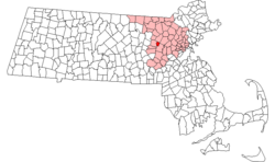
 Location in Middlesex County in Massachusetts |
||
| Coordinates: 42°26′00″N 71°27′00″W / 42.43333°N 71.45000°WCoordinates: 42°26′00″N 71°27′00″W / 42.43333°N 71.45000°W | ||
| Country | United States | |
| State | Massachusetts | |
| County | Middlesex | |
| Settled | 1638 | |
| Incorporated | 1871 | |
| Government | ||
| • Type | Open town meeting | |
| Area | ||
| • Total | 5.4 sq mi (13.9 km2) | |
| • Land | 5.2 sq mi (13.6 km2) | |
| • Water | 0.1 sq mi (0.3 km2) | |
| Elevation | 186 ft (57 m) | |
| Population (2010) | ||
| • Total | 10,106 | |
| • Density | 1,957.1/sq mi (748.3/km2) | |
| Time zone | Eastern (UTC-5) | |
| • Summer (DST) | Eastern (UTC-4) | |
| ZIP code | 01754 | |
| Area code(s) | 351 / 978 | |
| FIPS code | 25-39625 | |
| GNIS feature ID | 0618229 | |
| Website | web.maynard.ma.us/ | |
Maynard is a town in Middlesex County, Massachusetts, United States. The town is located 25 miles west of Boston, in the MetroWest region of Massachusetts. As of the 2010 census, the town population was 10,106.
Maynard was the site of the Assabet Woolen Mill, which produced wool fabrics near the Assabet River for over 100 years, from 1846 to 1950, under various owners. The American Powder Mills complex extending downstream along the river manufactured gunpowder from 1835 to 1940.Digital Equipment Corporation (DEC) was headquartered in the mill buildings in Maynard from 1957 until 1998, when it was bought by Compaq and subsequently closed. The mill complex operated as Clock Tower Place, 2000-2015, renamed "mill&main" under new ownership as of 2015[update]; The mill complex is currently renting space to office and light industry businesses. In the future, the complex will include retail areas and restaurants. At present, there are no plans for residences.
Maynard, located on the Assabet River, was incorporated as an independent municipality in 1871. Prior to that it was known as "Assabet Village" but was legally still part of the towns of Stow and Sudbury. There were some exploratory town-founding rumblings in 1870, followed by a petition to the Commonwealth of Massachusetts, filed January 26, 1871. State approval was granted April 19, 1871. In return, the new town paid Sudbury and Stow about $23,600 and $8,000 respectively. Sudbury got more money because it owned shares in the railroad, plus the wool mill and paper mill were in Sudbury, and more land came from Sudbury. The population of the newly formed town - at 1,820 - was larger than either of its parent towns.
...
Wikipedia

