Maynard, Arkansas
| Maynard, Arkansas | |
|---|---|
| Town | |
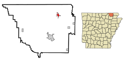
 Location in Randolph County and the state of Arkansas |
|
| Coordinates: 36°25′6″N 90°54′8″W / 36.41833°N 90.90222°WCoordinates: 36°25′6″N 90°54′8″W / 36.41833°N 90.90222°W | |
| Country | United States |
| State | Arkansas |
| County | Randolph |
| Government | |
| • Mayor | Don Sikes |
| Area | |
| • Total | 7.4 sq mi (2.9 km2) |
| • Land | 1.1 sq mi (2.9 km2) |
| • Water | 0 sq mi (0 km2) |
| Elevation | 384 ft (117 m) |
| Population (2010) | |
| • Total | 426 |
| • Density | 346.4/sq mi (131.4/km2) |
| Time zone | Central (CST) (UTC-6) |
| • Summer (DST) | CDT (UTC-5) |
| ZIP code | 72444 |
| Area code(s) | 870 |
| FIPS code | 05-44780 |
| GNIS feature ID | 0077620 |
Maynard is a town in Randolph County, Arkansas, United States. The population was 426 at the 2010 census.
Maynard is home to the Maynard Pioneer Museum and Park. A jail built in 1936 has a door made of wagon wheel rims. The last time it was used was in 1988, when it temporarily housed a man charged with public intoxication. The jail is beside Maynard Community Center.
Maynard was settled in the late 19th century.
Abbott Institute — later known as Maynard Baptist Academy and Ouachita Baptist Academy — was a boarding school established in 1894. Abbott Institute joined a school network associated with a college now known as Ouachita Baptist University in Arkadelphia.
The federal attorney Drew Bowers, a native of Pocahontas attended the academy in the mid-1890s before he transferred to the University of Arkansas at Fayetteville.
In 1928, Maynard Baptist Academy was sold to the Maynard School District. Its facilities were then used by the public school. All that remains of the academy today is an arch built by Maynard Baptist Academy's class of 1927, its last class. In 2008, Maynard School Alumni Association restored the arch on the school grounds as a memorial to the academy.
In January 2011, Verizon, Inc. erected a cellular phone tower (CDMA/3G) on the outskirts of Maynard.
Maynard is located at 36°25′6″N 90°54′8″W / 36.41833°N 90.90222°W (36.418200, -90.902166).
...
Wikipedia
