Matsushiro
|
Nagano 長野市 |
|||
|---|---|---|---|
| Core city | |||

From top of left, Zenkoji, Mount Togakushi, Kinasa village, Nagano Big Hat arena, Airial in Kawanakajima, Oku-Subana Valley, Marukome, which headquarter in Nagano, and famous for miso product company in Japan, Oyaki Japanese sweets, Togakushi ski place, and Matsushiro Castle
|
|||
|
|||
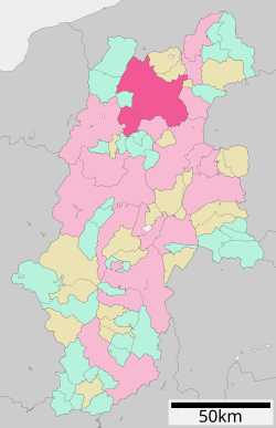
 Location of Tōmi in Nagano Prefecture |
|||
| Coordinates: 36°38′54.9″N 138°11′39.1″E / 36.648583°N 138.194194°ECoordinates: 36°38′54.9″N 138°11′39.1″E / 36.648583°N 138.194194°E | |||
| Country | Japan | ||
| Region | Chūbu (Kōshin'etsu) | ||
| Prefecture | Nagano | ||
| Government | |||
| • - Mayor | Hisao Katō | ||
| Area | |||
| • Total | 834.81 km2 (322.32 sq mi) | ||
| Population (October 2016) | |||
| • Total | 375,234 | ||
| • Density | 449/km2 (1,160/sq mi) | ||
| Time zone | Japan Standard Time (UTC+9) | ||
| Symbols | |||
| • Tree | Japanese Lime | ||
| • Flower | Apple | ||
| Phone number | 026-226-4911 | ||
| Address | 1613 Midori-chō, Nagano-shi, Nagano-ken 380-8512 | ||
| Website | www |
||
| Nagano, Nagano (1981–2010) | ||||||||||||||||||||||||||||||||||||||||||||||||||||||||||||
|---|---|---|---|---|---|---|---|---|---|---|---|---|---|---|---|---|---|---|---|---|---|---|---|---|---|---|---|---|---|---|---|---|---|---|---|---|---|---|---|---|---|---|---|---|---|---|---|---|---|---|---|---|---|---|---|---|---|---|---|---|
| Climate chart () | ||||||||||||||||||||||||||||||||||||||||||||||||||||||||||||
|
||||||||||||||||||||||||||||||||||||||||||||||||||||||||||||
|
||||||||||||||||||||||||||||||||||||||||||||||||||||||||||||
| J | F | M | A | M | J | J | A | S | O | N | D |
|
51
4
−4
|
50
5
−4
|
59
10
−1
|
54
17
5
|
75
23
11
|
109
26
16
|
134
29
20
|
98
31
21
|
129
26
17
|
83
19
10
|
44
13
3
|
46
7
−2
|
| Average max. and min. temperatures in °C | |||||||||||
| Precipitation totals in mm | |||||||||||
| Source: Japan Meteorological Agency | |||||||||||
| Imperial conversion | |||||||||||
|---|---|---|---|---|---|---|---|---|---|---|---|
| J | F | M | A | M | J | J | A | S | O | N | D |
|
2
38
25
|
2
40
25
|
2.3
49
31
|
2.1
63
41
|
3
73
51
|
4.3
78
60
|
5.3
84
68
|
3.9
88
70
|
...
| |||


