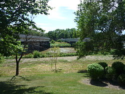
Maryland Bridge
| Maryland Bridge | |
|---|---|
 |
|
| Crosses | Assiniboine River |
| Locale | Winnipeg, Manitoba |
| Maintained by | City of Winnipeg |
| History | |
| Construction end | 2005 (northbound side) 2006 (southbound side) |
The Maryland Bridge is a bridge that crosses over the Assiniboine River in Winnipeg, Manitoba. It serves as a major transportation route for Winnipeg. The bridge connects Academy Road with Maryland Street and Sherbrook Street. The current structure is the third bridge to span this section of the river. All three bridges were called the Maryland Bridge. Nearby landmarks include Misericordia Health Centre, Cornish Library, and Shaare Zedek Synagogue.
The first bridge, which was made of steel truss, was constructed in 1894. It was nicknamed the Boundary Bridge, because Maryland Street once served as Winnipeg's western boundary.
After a Census of Traffic was conducted on the original bridge because of increased traffic and safety concerns, construction began on the second Maryland Bridge in 1920, and was completed in 1921. It was a concrete arch structure that included a colored aggregate of red granite, crushed to pass through a .75 inches (19 mm) screen, exposed by scrubbing with steel brushes, and cleaned by several washings of muriatic acid and water.
Winnipeg's only major bridge disaster occurred in 1937 when the 330-ton bridge counterweight fell on the deck of the second bridge. A corner post shaped as a cairn has been preserved from the second Maryland Bridge and is displayed by the current bridge. The bridge was closed for demolition upon the opening of the Twin Bridge's western span.
The current bridge, sometimes referred to as the Maryland Twin Bridge, consists of I-shaped AASHTO girders and twin, five-span continuous precast prestressed concrete structures. It was opened to traffic in two stages. The west structure on 8 November 1969 and the east structure on 5 August 1970. It was financed by the provincial government and constructed by the Metropolitan Corporation of Greater Winnipeg.
Renovations to the northbound span occurred in 2005. In 2006, the southbound span was renovated.
Coordinates: 49°52′41″N 97°9′40″W / 49.87806°N 97.16111°W
...
Wikipedia
