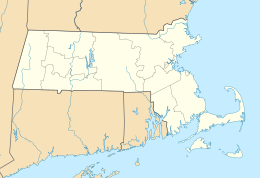
Martha’s Vineyard, Massachusetts
|
Native name: Noepe Nickname: The Vineyard, The Rock |
|
|---|---|

Map of Martha's Vineyard
|
|
| Geography | |
| Location | Dukes County, Massachusetts |
| Coordinates | 41°24′N 70°37′W / 41.400°N 70.617°W |
| Archipelago | Elizabeth Islands |
| Total islands | 3 |
| Major islands | 2 |
| Area | 87.48 sq mi (226.6 km2) |
| Length | 20.5 mi (33 km) |
| Highest elevation | 311 ft (94.8 m) |
| Highest point | Jay's Peak |
| Administration | |
|
United States
|
|
| State | Massachusetts |
| County | Dukes |
| Demographics | |
| Population | 16,535 (2010) |
| Pop. density | 66.2 /km2 (171.5 /sq mi) |
| Additional information | |
| Official website | mvol |
Martha's Vineyard (Wampanoag: Noepe, /ˈmɑːr.θəz.ˈvɪn.jərd/, often called just "the Vineyard") is an island located south of Cape Cod in Massachusetts that is known for being an affluent summer colony. It includes the smaller Chappaquiddick Island which is usually connected to the Vineyard, though storms and hurricanes have been known to separate the two. The last such separation of the islands was in 2007 and the two islands are again connected as of April 2, 2015.
It is the 58th largest island in the United States, with a land area of 100 square miles (260 km2), and the third largest on the East Coast of the United States, after Long Island and Mount Desert Island. The island constitutes the bulk of Dukes County, Massachusetts, which also includes the Elizabeth Islands and the island of Nomans Land.
The Vineyard was home to one of the earliest known deaf communities in the United States; consequently, a special sign language developed on the island called Martha's Vineyard Sign Language (MVSL).
...
Wikipedia

