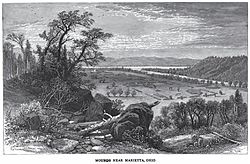
Marietta Earthworks

Drawing of Marietta Earthworks
|
|
| Location |
Washington County, Ohio, |
|---|---|
| Region | Washington County, Ohio |
| Coordinates | 39°25′12″N 81°27′7″W / 39.42000°N 81.45194°W |
| History | |
| Founded | 100 BCE |
| Abandoned | 500 CE |
| Cultures | Ohio Hopewell |
| Architecture | |
| Architectural styles | Platform mounds, burial mound, enclosuress, |
The Marietta Earthworks is an archaeological site located at the confluence of the Muskingum and Ohio Rivers in Washington County, Ohio, United States. Most of this Hopewellian complex of earthworks is now covered by the modern city of Marietta. Archaeologists have dated the ceremonial site's construction to approximately 100 BCE to 500 CE.
Early European American settlers gave the structures Latin names. The complex includes the Sacra Via (meaning "sacred way"), three walled enclosures, the Quadranaou, Capitolium (meaning "capital") and at least two other additional platform mounds, and the Conus burial mound and its accompanying ditch and embankment.
The Capitolium is a truncated pyramidal mound with three ramps leading to its summit. It is slightly smaller than the Quadranaou mound. Although not in pristine condition, it has been mostly preserved due to the construction of the Washington County Library on its summit in 1916. According to measurements and research done by archaeoastronomer William F. Romain in the 1990s, when the mound was constructed it was aligned to within about one degree with the winter solstice sunset.
The Conus is a large burial mound which is encompassed by an embankment and a ditch, much like a round barrow. A gap in the embankment and an earthen ramp across the ditch gives access to the base of the mound. When an earthen wall was constructed outside the ditch, as in this location, it means that the mound was for ceremonial use, not as a type of fortification. The mound today stands 30 feet (9.1 m) in height and is the sole intact feature of the earthworks. The ditch surrounding the mound is 15 feet (4.6 m) in width and 4 feet (1.2 m) deep, with its surrounding embankment measuring 20 feet (6.1 m) across its base and 585 feet (178 m) in circumference.
...
Wikipedia

