Marianna, Arkansas
| Marianna, Arkansas | |
|---|---|
| City | |

Clockwise, from top: Lee County Courthouse, Marianna Commercial Historic District, Lee County Historical Museum, and the General Robert E. Lee Monument in City Park
|
|
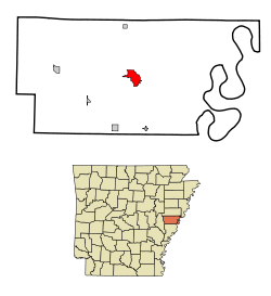
 Location in Lee County and the state of Arkansas |
|
| Coordinates: 34°46′26″N 90°45′54″W / 34.77389°N 90.76500°WCoordinates: 34°46′26″N 90°45′54″W / 34.77389°N 90.76500°W | |
| Country | United States |
| State | Arkansas |
| County | Lee |
| Area | |
| • Total | 3.6 sq mi (9.3 km2) |
| • Land | 3.6 sq mi (9.3 km2) |
| • Water | 0 sq mi (0 km2) |
| Elevation | 226 ft (69 m) |
| Population (2010) | |
| • Total | 4,115 |
| • Density | 1,439.2/sq mi (557.1/km2) |
| Time zone | Central (CST) (UTC-6) |
| • Summer (DST) | CDT (UTC-5) |
| ZIP code | 72360 |
| Area code(s) | 870 |
| FIPS code | 05-44120 |
| GNIS feature ID | 0058123 |
Marianna is a city in and the county seat of Lee County, Arkansas. Located along the L'Anguille River in the Arkansas Delta just north of the St. Francis National Forest, the community was known as Walnut Ridge until 1852 when it became known as Marianna. The city's economy has historically been based on agricultural, especially cotton production. The city is located along Crowley's Ridge Parkway and the Great River Road, both National Scenic Byways showcasing Crowley's Ridge and the Mississippi River.
The community was established by Col. Walter H. Otey in 1848 and was known as Walnut Ridge until 1852.
Marianna is located at the north-west tip of St. Francis National Forest.
Marianna is located at 34°46′26″N 90°45′54″W / 34.77389°N 90.76500°W (34.773969, -90.765097).
According to the United States Census Bureau, the city has a total area of 3.6 square miles (9.3 km2), all of it land. The town's current mayor is Hon. Mayor Jimmy Williams who took office on Jan. 1, 2011.
As of the census of 2010, there were 4,115 people, 1,664 households, and 1,068 families residing in the city. The population density was 1,440.0 people per square mile (555.7/km²). There were 2,196 housing units at an average density of 610.4 per square mile (235.5/km²). The racial makeup of the city was 20.9% White, 76.6% Black or African American, 0.2% Native American, 0.8% Asian, 0.0% from other races, and 1.3% from two or more races. 0.7% of the population were Hispanic or Latino of any race.
...
Wikipedia
