Margate
| Margate | |
|---|---|
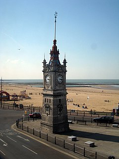
 Margate Clock Tower |
|
| Margate shown within Kent | |
| Population | 61,223 (2011) |
| OS grid reference | TR355705 |
| • London | 64.1 mi (104 km) W |
| District | |
| Shire county | |
| Region | |
| Country | England |
| Sovereign state | United Kingdom |
| Post town | MARGATE |
| Postcode district | CT9 |
| Dialling code | 01843 |
| Police | Kent |
| Fire | Kent |
| Ambulance | South East Coast |
| EU Parliament | South East England |
| UK Parliament | |
Margate is a seaside town in the district of Thanet in Kent, England. It lies 38.1 miles (61.3 km) east-north-east of Maidstone, on the coast along the North Foreland and contains the areas of Cliftonville, Garlinge, Palm Bay and Westbrook.
Margate was recorded as "Meregate" in 1264 and as "Margate" in 1299, but the spelling continued to vary into modern times. The name is thought to refer to a pool gate or gap in a cliff where pools of water are found, often allowing swimmers to jump in. The cliffs of the Isle of Thanet are composed of chalk, a fossil-bearing rock.
The town's history is tied closely to the sea and it has a proud maritime tradition. Margate was a "limb" of Dover in the ancient confederation of the Cinque ports. It was added to the confederation in the 15th century. Margate has been a leading seaside resort for at least 250 years. Like its neighbour Ramsgate, it has been a traditional holiday destination for Londoners drawn to its sandy beaches. Margate had a Victorian pier which was largely destroyed by a storm in 1978.
Like Brighton and Southend, Margate was infamous for gang violence between mods and rockers in the 1960s, and mods and skinheads in the 1980s.
The Turner Contemporary art gallery occupies a prominent position next to the harbour. The Thanet Offshore Wind Project, completed in 2010, is visible from the seafront.
...
Wikipedia

