Mansfield, Massachusetts
| Mansfield, Massachusetts | ||
|---|---|---|
| Town | ||

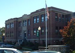
Mansfield Town Hall
|
||
|
||
 Location in Bristol County in Massachusetts |
||
| Coordinates: 42°02′00″N 71°13′10″W / 42.03333°N 71.21944°WCoordinates: 42°02′00″N 71°13′10″W / 42.03333°N 71.21944°W | ||
| Country | United States | |
| State | Massachusetts | |
| County | Bristol | |
| Settled | 1658 | |
| Incorporated | 1775 | |
| Government | ||
| • Type | Open town meeting | |
| • Town Manager |
William R. Ross, Town Manager | |
| • Board of Selectmen |
Jess Aptowitz Kevin Moran (Chair) Doug Annino Olivier Kozlowski George Dentino (Vice Chair) |
|
| Area | ||
| • Total | 20.7 sq mi (53.7 km2) | |
| • Land | 20.5 sq mi (53.0 km2) | |
| • Water | 0.3 sq mi (0.7 km2) | |
| Elevation | 160 ft (49 m) | |
| Population (2010) | ||
| • Total | 23,184 | |
| • Density | 1,130.9/sq mi (437.4/km2) | |
| Time zone | Eastern (UTC-5) | |
| • Summer (DST) | Eastern (UTC-4) | |
| ZIP code | 02048 | |
| Area code(s) | 508 / 774 | |
| FIPS code | 25-38225 | |
| GNIS feature ID | 0618283 | |
| Website | http://www.mansfieldma.com/ | |
Mansfield is a town in Bristol County, Massachusetts, United States. As of the United States 2010 Census, the town population is 23,184. Mansfield is in the south-southwest suburbs of Boston and is also close to Providence, Rhode Island. The village of Mansfield Center is located in the town. The town is twinned with Mansfield in Nottinghamshire, England.
Mansfield was first settled in 1658 and was officially incorporated in 1775. It was named for William Murray, 1st Earl of Mansfield, a pro-colonial member of the House of Lords. Mansfield is the home of the Xfinity Center (formerly known as Great Woods, Tweeter Center and Comcast Center) concert venue, one of the most popular in New England. It is also the birthplace of Honey Dew Donuts, a regional New England chain of donut shops.
Benjamin E. Bates, an industrialist and philanthropist, who was the founder of Bates College was born in Mansfield in 1808. Stove and furnace manufacturer and innovator Gordon Chilson (1804–1877) worked here.
According to the United States Census Bureau, the town has a total area of 20.7 square miles (54 km2), of which, 20.5 square miles (53 km2) of it is land and 0.3 square miles (0.78 km2) of it (1.25%) is water. There are five conservation areas in the town. They are, from largest to smallest: the Great Woods Conservation Area, Maple Park Conservation Area, York Conservation Area, Marie Strese Conservation Area, and Sweet Pond Conservation Area. The town is bisected by the Canoe, Rumford and Wading Rivers, as well as many small brooks which are all part of the Taunton River Watershed.
...
Wikipedia

