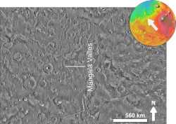
Mangala Valles

Mangala Valles and Mangala Fossa
(THEMIS image) |
|
| Coordinates | 11°36′S 151°00′W / 11.6°S 151.0°WCoordinates: 11°36′S 151°00′W / 11.6°S 151.0°W |
|---|---|
| Length | 828.0 km |
Mangala Valles is a complex system of criss-crossing channels on Mars, located in the Tharsis region and in the Memnonia quadrangle. It originates in the Hesperian and Amazonian epochs. It is thought to be an outflow channel, carved by catastrophic floods, and the release of vast quantities of water across the Martian surface. This flooding was probably initiated by tectonic stretching and the formation of a graben, Mangala Fossa, at the channels' head, perhaps breaching a pressurized aquifer trapped beneath a thick "cryosphere" (layer of frozen ground) beneath the surface. Mangala Valles contains several basins which filled, then the overflow went through a series of spillways. One source of waters for the system was Memonia Fossae, but water also probably came from a large basin centered at 40 degrees S.
A recent study that used photogeologic analysis, geomorphic surface mapping, cratering statistics, and relative stratigraphy, demonstrated that Mangala Valles was flooded by water at least twice and covered with lava at least three times during the Late Amazonian. The presence of scoured bedrock at the base of the mapped stratigraphy, together with evidence from crater retention ages, suggests that fluvial activity came before lava flows. These alternating periods of aqueous flooding and volcanism are similar to that of other outflow systems on Mars, such as Kasei Valles and Ravi Vallis
There are many wind-sculpted ridges or yardangs covering many of the surfaces in the Mangala Valles region.
"Mangala" is the name for Mars in Jyotish (or Hindu) astrology.
Mangala Valles with a streamlined island, as seen by THEMIS.
Mangala Valles, as seen by HiRISE.
...
Wikipedia
