Malabo Airport
|
Malabo International Airport Aeropuerto Internacional de Malabo |
|||||||||||
|---|---|---|---|---|---|---|---|---|---|---|---|
 |
|||||||||||
| Summary | |||||||||||
| Airport type | Military/Public | ||||||||||
| Operator | Aeropuertos De Guinea Ecuatorial (ADGE) | ||||||||||
| Serves | Malabo | ||||||||||
| Location | Bioko, Equatorial Guinea | ||||||||||
| Hub for | |||||||||||
| Elevation AMSL | 76 ft / 23 m | ||||||||||
| Coordinates | 03°45′18″N 08°42′31″E / 3.75500°N 8.70861°E | ||||||||||
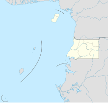
| Map | |||||||||||
| Location of airport in Equatorial Guinea | |||||||||||
| Runways | |||||||||||
|
|||||||||||
| Statistics (2009) | |||||||||||
|
|||||||||||
| Passengers | 283,991 |
|---|
Malabo Airport or Saint Isabel Airport (IATA: SSG, ICAO: FGSL) (Spanish: Aeropuerto de Malabo), is an airport located at Punta Europa, Bioko Island, Equatorial Guinea. The airport is named after the capital, Malabo, approximately 9 kilometres to the east.
Until the discovery of oil within the borders of Equatorial Guinea during the mid-1990s, the airport was a tin-roofed shack that only had one international flight, the government was the main user of the airport. The airport is also used by the few aircraft belonging to the armed forces. During the Nigerian Civil War of the late 1960s, the airport was used as a base for flights into Biafra.
The old tin shack that used to greet arrivals has been replaced by a modern airport lounge. The airport now receives a comfortable amount of foreign traffic, although parts of the runway are in need of repair. Despite recent progress, Malabo airport is one of only three paved airports in Equatorial Guinea, the others being Bata Airport, located on mainland Africa, and Annobon Airport, on Annobon. The hangars can accommodate large aircraft such as the McDonnell Douglas DC-10 or the C-130 Hercules. In 2001, the airport served 34,500 passengers and that number has since risen.
...
Wikipedia

