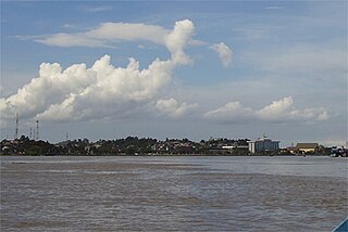
Mahakam River
| Mahakam | |
| River | |
|
Mahakam River at Samarinda
|
|
| Country | Indonesia |
|---|---|
| Province | East Kalimantan |
| Tributaries | |
| - left | Kedang Pahu |
| - right | Kedang Rantau, Kedang Kepala, Belayan |
| Towns/Cities | Samarinda, Tenggarong, Sebulu, Muara Kaman, Kotabangun, Melak, Long Iram |
| Source | Cemaru |
| - elevation | 1,681 m (5,515 ft) |
| Mouth | Mahakam Delta, Makassar Strait |
| - location | Mahakam Delta, Sungai Mariam, Indonesia |
| - elevation | 0 m (0 ft) |
| Length | 980 km (609 mi) |
| Basin | 77,100 km2 (29,768 sq mi) |
| Discharge | for Melak |
| - average | 2,500 m3/s (88,287 cu ft/s) |
| - max | 3,250 m3/s (114,773 cu ft/s) |
The Mahakam River is in Indonesia. It flows 980 km from the district of Long Apari in the highlands of Borneo, to its mouth at the Makassar Strait.
The city of Samarinda, the provincial capital of East Kalimantan, lies along the river 48 km (30 mi) from the river mouth. The delta Mahakam river consist of specific micro climate which is influenced by high and low tide at sea level.
The Mahakam River[2] is the largest river in East Kalimantan, Indonesia, with a catchment area of approximately 77,100 km2. The catchment lies between 2˚N to 1˚S latitude and 113˚E to 118˚E longitude. The river originates in Cemaru from where it flows south-eastwards, meeting the River Kedang Pahu at the city of Muara Pahu. From there, the river flows eastward through the Mahakam lakes region, which is a flat tropical lowland area surrounded by peat land. Thirty shallow lakes are situated in this area, which are connected to the Mahakam through small channels [3]. Downstream of the connection with the Semayang and Melintang lakes, the Mahakam meets three other main tributaries - the rivers Belayan, Kedang Kepala, and Kedang Rantau - and flows south-eastwards through the Mahakam delta distributaries, to the Makassar Strait.
Kalimantan, where the Mahakam lies, is part of the Sunda Continental Plate. The large island has mountain ranges between Indonesia and Malaysia. As described by van Bemmelen (1949), River Mahakam rises in Cemaru (1,681 m) in the centre of Kalimantan, from there it cuts through the pre-tertiary axis of the island east of the Batuayan (1,652 m) and then reaches the tertiary basin of Kutai. Its middle course traverses a lowland plain with many marshy lakes. This intermontane depression is separated from the neighboring basin, the Barito depression, by a broad hilly tract of less than 500 metres (1,600 ft) altitude. After this region, the Mahakam cuts through the Samarinda anticlinorium and reaches its alluvial delta, which spreads like a broad fan over the shelf-sea, with a base of 65 kilometres (40 mi) and a radius of about 30 kilometres (19 mi).
...
Wikipedia


