Mühlau
| Mühlau | ||
|---|---|---|
 |
||
|
||
| Coordinates: 47°14′N 8°24′E / 47.233°N 8.400°ECoordinates: 47°14′N 8°24′E / 47.233°N 8.400°E | ||
| Country | Switzerland | |
| Canton | Aargau | |
| District | Muri | |
| Area | ||
| • Total | 5.52 km2 (2.13 sq mi) | |
| Elevation | 396 m (1,299 ft) | |
| Population (Dec 2015) | ||
| • Total | 1,068 | |
| • Density | 190/km2 (500/sq mi) | |
| Postal code | 5642 | |
| SFOS number | 4235 | |
| Surrounded by | Auw, Beinwil (Freiamt), Benzenschwil, Hünenberg (ZG), Merenschwand, Sins | |
| Website |
www SFSO statistics |
|
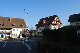
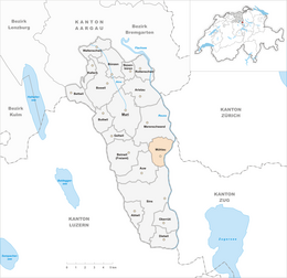
Mühlau is a municipality in the district of Muri in the canton of Aargau in Switzerland.
The earliest evidence of human settlement in Mühlau is the remains of a Roman villa. The modern municipality of Mühlau is first mentioned in 1274 as Mulnowe. During the High and Late Middle Ages the major landholders in Mühlau were the Lords of Hünenberg, the Freie of Eschenbach and the Cistercian monastery at Eschenbach. From 1393/94 until 1803 it was part of the Merenschwand district. In 1810 the municipality of Mühlau was formed, containing the hamlet of Krähenbühl. In 1878 the hamlets of Schoren and Kestenberg left Merenschwand to join the municipality.
It was part of the parish of Sins, though the hamlets of Schoren and Kestenberg were part of the Merenschwand parish. In 1582, the St. Anna Chapel was consecrated. In 1852-53 the present parish church of St. Anna was constructed.
In 1881 the rail line from Muri to Rotkreuz was built through the village. Mühlau rail station was finished in 1885. In 1940 the Reuss river bridge replaced the ferry, which had been in service since 1393.
Mühlau is still a farming village. In 2005 agriculture provided almost a third of the jobs in the community.
Mühlau has an area, as of 2009[update], of 5.52 square kilometers (2.13 sq mi). Of this area, 3.86 km2 (1.49 sq mi) or 69.9% is used for agricultural purposes, while 0.73 km2 (0.28 sq mi) or 13.2% is forested. Of the rest of the land, 0.6 km2 (0.23 sq mi) or 10.9% is settled (buildings or roads), 0.17 km2 (0.066 sq mi) or 3.1% is either rivers or lakes and 0.15 km2 (37 acres) or 2.7% is unproductive land.
...
Wikipedia


