Lumberton, Mississippi
| Lumberton, Mississippi | |
|---|---|
| City | |

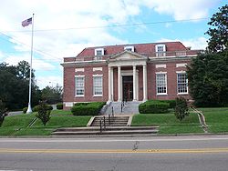
The U.S. Post Office in Lumberton, Mississippi
|
|
 Location of Lumberton, Mississippi |
|
| Location in the United States | |
| Coordinates: 31°0′14″N 89°27′13″W / 31.00389°N 89.45361°WCoordinates: 31°0′14″N 89°27′13″W / 31.00389°N 89.45361°W | |
| Country | United States |
| State | Mississippi |
| Counties | Lamar, Pearl River |
| Government | |
| • Mayor | Ben Winston |
| Area | |
| • Total | 7.3 sq mi (18.9 km2) |
| • Land | 7.3 sq mi (18.8 km2) |
| • Water | 0.0 sq mi (0.1 km2) |
| Elevation | 295 ft (90 m) |
| Population (2000) | |
| • Total | 2,228 |
| • Density | 307.1/sq mi (118.6/km2) |
| Time zone | Central (CST) (UTC-6) |
| • Summer (DST) | CDT (UTC-5) |
| ZIP code | 39455 |
| Area code(s) | 601 |
| FIPS code | 28-42640 |
| GNIS feature ID | 0693845 |
Lumberton is a city in Lamar and Pearl River counties, Mississippi. It is part of the Hattiesburg, Mississippi Metropolitan Statistical Area. The population was 2,228 at the 2000 census.
The city was named for the local lumber industry.
Lumberton is located at 31°0′14″N 89°27′13″W / 31.00389°N 89.45361°W (31.003888, -89.453544). Most of the city is in Lamar County, with a small portion extending east into adjacent Pearl River County. In the 2000 census, 2,200 of the city's 2,228 residents (98.7%) lived in Lamar County and 28 (1.3%) in Pearl River County.
According to the United States Census Bureau, the city has a total area of 7.3 square miles (18.9 km²), of which 7.3 square miles (18.8 km²) is land and 0.04 square mile (0.1 km²) (0.27%) is water.
As of the census of 2000, there were 2,228 people, 829 households, and 602 families residing in the city. The population density was 307.1 people per square mile (118.5/km²). There were 920 housing units at an average density of 126.8 per square mile (48.9/km²). The racial makeup of the city was 45.56% White, 53.64% African American, 0.27% Native American, 0.09% Asian, 0.04% from other races, and 0.40% from two or more races. Hispanic or Latino of any race were 0.45% of the population.
...
Wikipedia

