Lumber City, Pennsylvania
| Lumber City, Pennsylvania | |
|---|---|
| former Borough | |
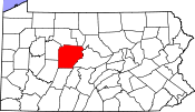
 Location of Lumber City in Clearfield County |
|
 Location of Clearfield County in Pennsylvania |
|
| Location in Pennsylvania | |
| Coordinates: 40°55′57″N 78°34′48″W / 40.93250°N 78.58000°WCoordinates: 40°55′57″N 78°34′48″W / 40.93250°N 78.58000°W | |
| Country | United States |
| State | Pennsylvania |
| County | Clearfield |
| Settled | 1835 |
| Incorporated | 1857 |
| Dissolved | 2014 |
| Government | |
| • Type | Borough Council |
| Area | |
| • Total | 2.7 sq mi (7.5 km2) |
| • Land | 2.7 sq mi (7.1 km2) |
| • Water | 0.2 sq mi (0.4 km2) |
| Elevation | 1,220 ft (370 m) |
| Population (2010) | |
| • Total | 76 |
| • Density | 28/sq mi (10.7/km2) |
| Time zone | Eastern (EST) (UTC-5) |
| • Summer (DST) | EDT (UTC-4) |
| Area code(s) | 814 |
Lumber City is a former borough in Clearfield County, Pennsylvania, United States. The population was 76 at the 2010 census.
The borough ceased to be a separate municipality on January 6, 2014, and became part of Ferguson Township.
Lumber City is located southwest of the center of Clearfield County at 40°55′57″N 78°34′48″W / 40.93250°N 78.58000°W (40.932590, -78.580051), on the north side of the West Branch Susquehanna River. It is bordered to the north by Penn Township and to the northeast by Pike Township.
Pennsylvania Route 969 passes through the community following the West Branch, leading northeast (downstream) 6 miles (10 km) to Curwensville and west (upstream) 5 miles (8 km) to U.S. Route 219 at Bells Landing. Pennsylvania Route 729 crosses the West Branch at Lumber City and leads north 4 miles (6 km) to US 219 at Grampian and south 12 miles (19 km) to Glen Hope.
According to the United States Census Bureau, the borough of Lumber City had a total area of 2.9 square miles (7.5 km2), of which 2.7 square miles (7.1 km2) was land and 0.15 square miles (0.4 km2), or 5.01%, was water, prior to its merger with Ferguson Township. The upstream end of Curwensville Lake on the West Branch is at Lumber City.
...
Wikipedia

