Loyall, Kentucky
| Loyall, Kentucky | |
|---|---|
| City | |
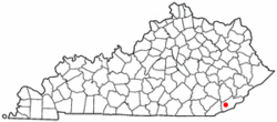
 Location of Loyall, Kentucky |
|
| Coordinates: 36°51′7″N 83°21′10″W / 36.85194°N 83.35278°WCoordinates: 36°51′7″N 83°21′10″W / 36.85194°N 83.35278°W | |
| Country | United States |
| State | Kentucky |
| County | Harlan |
| Incorporated | 1924 |
| Government | |
| • Type | Mayor-Council |
| • Mayor | Clarence Longworth |
| Area | |
| • Total | 0.3 sq mi (0.9 km2) |
| • Land | 0.3 sq mi (0.9 km2) |
| • Water | 0.0 sq mi (0.0 km2) |
| Elevation | 1,175 ft (358 m) |
| Population (2000) | |
| • Total | 766 |
| • Density | 2,246.5/sq mi (867.4/km2) |
| Time zone | Eastern (EST) (UTC-5) |
| • Summer (DST) | EDT (UTC-4) |
| ZIP code | 40854 |
| Area code(s) | 606 |
| FIPS code | 21-48288 |
| GNIS feature ID | 0497327 |
Loyall is a home rule-class city in Harlan County, Kentucky, in the United States. The population was 766 at the time of the 2000 U.S. census.
The community grew up around an L&N switching yard and maintenance facility, first constructed in 1920. The local post office (est. 1922) was originally known as Shonn, from local slang for a rail siding. The name Loyall was adopted in 1932. It remains unclear if it honors a company official or some other resident.
Loyall is located at 36°51′7″N 83°21′10″W / 36.85194°N 83.35278°W (36.852046, -83.352870). According to the United States Census Bureau, the city has a total area of 0.3 square miles (0.78 km2), all of it land.
As of the census of 2000, there were 766 people, 339 households, and 227 families residing in the city. The population density was 2,246.5 people per square mile (869.9/km²). There were 368 housing units at an average density of 1,079.3 per square mile (417.9/km²). The racial makeup of the city was 97.91% White, 0.78% Native American, 0.52% Asian, and 0.78% from two or more races. Hispanic or Latino of any race were 0.13% of the population.
...
Wikipedia
