Los Amates
| Los Amates | |
|---|---|
| Municipality of Guatemala | |

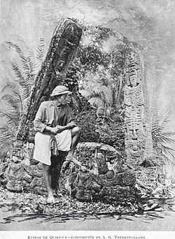
Quiriguá, Los Amates, in 1897. Picture from Alberto G. Valdeavellano
|
|
| Location in Guatemala | |
| Coordinates: 15°16′00″N 89°06′00″W / 15.26667°N 89.10000°W | |
| Country |
|
| Department | Izabal Department |
| Settled | 30 June 1916 |
| Government | |
| • Mayor (2016-2020) | Milton Panteleón |
| Elevation | 253 ft (77 m) |
| Population (2002) | |
| • Total | 57,040 |
| • Density | 90/sq mi (33/km2) |
| Time zone | GMT_6 |
| Climate | Am |
Los Amates is a municipality in the Izabal department of Guatemala. The population is about 56,000. The mayor is currently Marco Tulio Ramirez Estrada. Los Amates is located on the Motagua River, 6 kilometres (3.7 mi) from the ruins of the ancient Maya city of Quiriguá.
Quiriguá is an ancient Maya archaeological site in Los Amates. It is a medium-sized site covering approximately 3 square kilometres (1.2 sq mi) along the lower Motagua River, with the ceremonial center about 1 km (0.6 mi) from the north bank. During the Maya Classic Period (AD 200–900), Quiriguá was situated at the juncture of several important trade routes. The site was occupied by 200, construction on the acropolis had begun by about 550, and an explosion of grander construction started in the 8th century. All construction had halted by about 850, except for a brief period of reoccupation in the Early Postclassic (c. 900 – c. 1200). Quiriguá shares its architectural and sculptural styles with the nearby Classic Period city of Copán, with whose history it is closely entwined.
The area was largely abandoned during the Spanish Colony of Guatemala, and the first European visitor to publish an account of Los Amates was English architect and artist Frederick Catherwood, who reached the Quiriguá ruins in 1840, during the turbulent times of president general Rafael Carrera. The previous landowner, by the surname of Payés, had related the existence of the ruins to his sons and to Carlos Meiney, a Jamaican Englishman resident in Guatemala. The elder Payés had recently died and passed the land to his sons and, since neither Meiney nor Payés' sons had visited the land containing the ruins, they invited John Lloyd Stephens and Catherwood to join them on their first trip to the site. Stephens had other duties to attend to, but Catherwood was able to accompany the Payés brothers to Quiriguá. Due to adverse conditions he was only able to stay a short time at the ruins, but made drawings of two of the stelae, which were published with a short account of Catherwood's visit in John Lloyd Stephens's book Incidents of Travel in Central America, Chiapas, and Yucatan in 1841. A longer account of the ruins was made in 1854 by Dr. Karl Scherzer.
...
Wikipedia

