Long Horseley
| Longhorsley | |
|---|---|
 Longhorsley |
|
| Longhorsley shown within Northumberland | |
| Population | 887 (2011 census) |
| OS grid reference | NZ145945 |
| Unitary authority | |
| Ceremonial county | |
| Region | |
| Country | England |
| Sovereign state | United Kingdom |
| Post town | MORPETH |
| Postcode district | NE65 |
| Dialling code | 01670 |
| Police | Northumbria |
| Fire | Northumberland |
| Ambulance | North East |
| EU Parliament | North East England |
| UK Parliament | |
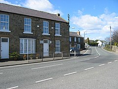
Longhorsley is a village in Northumberland, England about 7 miles (11 km) northwest of Morpeth, and about 14 miles (23 km) south of Alnwick. The A697 road passes through the village linking it with Morpeth, Wooler and Coldstream in Scotland. There are 7 "Streets" in Longhorsley: Whitegates, Church View, Drummonds Close, South Road, West Road, East Road and Reivers Gate. The village is bordered on the north by the River Coquet. The village formerly lay in three separate townships: Bigges Quarter, Freeholders Quarter and Riddells Quarter.
Local amenities at present include: St Helen's First School; Millar's Shop; Albion House Hairdressing; and The Shoulder of Mutton Pub.
The population of Longhorsley Parish is approximately 800, measured at the 2011 Census as 887, and is essentially a residential community for those who work in South Northumberland and Tyneside.
The village has a long history. In 1196 we find it referred to as Horsieg, a "woodland clearing where horses are kept" - although it was a pretty tough place for a horse: one traveller, Eneas Mackenzie (1778–1832), described it in his view of Northumberland, as "the prolific source of contagious disorders incident to cattle and of little real use in its present state". Longhorsley Moor is high and bleak (in the winter of 1890 the mail-gig was blown over in a gale and the driver found with his neck broken). In the course of time the manor of Longhorsley was owned by the Gospatricks who gave it to the Merlays, and then it passed into the hands of the Horsleys and, later, to the great Catholic family, the Riddells.
Longhorseley is in the electoral ward of Chevington with Longhorsley. This ward covers both East Chevington and Longhorsley plus their surrounding areas. The total population of this ward at the 2011 Census was 5,596.
The Devil's Causeway passes the village less than 2 miles (3 km) to the west. The causeway is a Roman road which starts at Port Gate on Hadrian's Wall, north of Corbridge, and extends 55 miles (89 km) northwards across Northumberland to the mouth of the River Tweed at Berwick-upon-Tweed.
...
Wikipedia

