London Road, Reading
| Bath Road | |
|---|---|

| |
| Route information | |
| Length | 126.64 mi (203.81 km) |
| Major junctions | |
| East end | City of London |
|
|
|
| West end | Avonmouth |
| Location | |
| Primary destinations |
Westminster Hammersmith Hounslow Heathrow Airport Slough Maidenhead Reading Newbury Marlborough Chippenham Bath Bristol |
| Road network | |
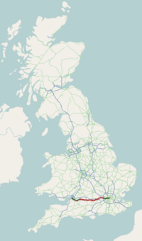
The A4 is a major road in England from Central London to Avonmouth via Heathrow Airport, Reading, Bath and Bristol. It is historically known as the Bath Road with newer sections including the Great West Road and Portway. The road was once the main route from London to Bath and the west of England and formed, after the A40, the second main western artery from London. Much of the route is now paralleled by the M4 motorway, which carries the bulk of long distance traffic in this corridor, leaving the A4 primarily for local traffic, though sections in London and Bristol particularly are still major through routes.
The A4 has gone through many transformations through the ages from pre-Roman routes, Roman roads (such as the one passing Silbury Hill), and basic wagon tracks. During the Middle Ages, most byways and tracks served to connect villages with their nearest market town. A survey of Savernake Forest near Hungerford in 1228 mentions "The King’s Street" running between the town and Marlborough. This street corresponded roughly with the route of the modern A4. In 1632, Thomas Witherings was appointed Postmaster of Foreign Mails by Charles I. Three years later, the king charged him with building six "Great Roads" to aid in the delivery of the post, of which the Great West Road was one. It was not until the 17th century that a distinct route between London and Bristol started to resemble today's road. During the 17th century, the A4 was known as the Great Road to Bristol. When Queen Anne started patronising the spa city of Bath, the road became more commonly known as Bath Road. Over the years, the direction of the road has taken many detours depending on such factors as changes in tolls or turnpike patronage. For example, in 1750 the toll road from London was altered to go through Melksham; and in 1695 the map maker, John Ogilby, produced a map of the Hungerford area of the Great West Road showing two possible routes.
...
Wikipedia

