Lobuche
| Lobuche East | |
|---|---|

Lobuche East as viewed from Lobuche Alps
|
|
| Highest point | |
| Elevation | 6,119 m (20,075 ft) (Lobuche East) |
| Prominence | 275 metres (902 ft) |
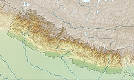
| Coordinates | 27°57′34.2″N 86°47′23.8″E / 27.959500°N 86.789944°ECoordinates: 27°57′34.2″N 86°47′23.8″E / 27.959500°N 86.789944°E |
| Geography | |
| Location | Khumbu, Nepal |
| Parent range | Himalayas |
| Climbing | |
| First ascent | April 25, 1984 |
| Easiest route | Scramble/Rock/Snow Climb |
Lobuche (also spelt Lobuje) is a Nepalese mountain which lies close to the Khumbu Glacier and the settlement of Lobuche. There are two main peaks, Lobuche Far East and Lobuche East (often mistaken for Lobuche West which is a separate mountain further west). At 6,145 metres (20,161 ft), Lobuche East is 26 metres (85 ft) higher. Between the two peaks is a long deeply notched ridge.
The first recorded ascent of Lobuche East was made by Laurence Nielson and Sherpa Ang Gyalzen on April 25, 1984.
...
Wikipedia

