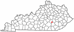
Livingston, Kentucky
| Livingston, Kentucky | |
|---|---|
| City | |
 Location of Livingston, Kentucky |
|
| Coordinates: 37°17′55″N 84°13′0″W / 37.29861°N 84.21667°WCoordinates: 37°17′55″N 84°13′0″W / 37.29861°N 84.21667°W | |
| Country | United States |
| State | Kentucky |
| County | Rockcastle |
| Incorporated | 1880 |
| Reïncorporated | 1943 |
| Named for | a local landowner |
| Area | |
| • Total | 0.3 sq mi (0.8 km2) |
| • Land | 0.3 sq mi (0.8 km2) |
| • Water | 0.0 sq mi (0.0 km2) |
| Elevation | 912 ft (278 m) |
| Population (2010) | |
| • Total | 226 |
| • Density | 753.3/sq mi (282.5/km2) |
| Time zone | Eastern (EST) (UTC-5) |
| • Summer (DST) | EDT (UTC-4) |
| ZIP code | 40445 |
| Area code(s) | 606 |
| FIPS code | 21-47098 |
| GNIS feature ID | 513549 |
Livingston is a home rule-class city in Rockcastle County, Kentucky, in the United States. The population was 226 during the 2010 U.S. census. It is part of the Richmond-Berea micropolitan area.
The first post office at the site was known as Fish Point and opened in 1840. The L&N reached the settlement in 1870 and named its station after James Livingston, a local landowner. The post office was renamed Livingston Station in 1879 and, following the city's 1880 incorporation, Livingston in 1882.
Livingston is located at 37°17′55″N 84°13′0″W / 37.29861°N 84.21667°W (37.298551, -84.216661). According to the United States Census Bureau, the city has a total area of 0.3 square miles (0.78 km2), all land.
As of the census of 2000, there were 228 people, 104 households, and 63 families residing in the city. The population density was 704.4 people per square mile (275.1/km²). There were 122 housing units at an average density of 376.9 per square mile (147.2/km²). The racial makeup of the city was 96.05% White and 3.95% Native American. Hispanic or Latino of any race were 3.51% of the population.
...
Wikipedia
