Liverpool West Derby (UK Parliament constituency)
| Liverpool, West Derby | |
|---|---|
|
Borough constituency for the House of Commons |
|

Boundary of Liverpool, West Derby in Merseyside.
|
|

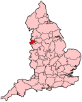
Location of Merseyside within England.
|
|
| County | Merseyside |
| Electorate | 62,709 (December 2010) |
| Current constituency | |
| Created | 1885 |
| Member of parliament | Stephen Twigg (Labour Co-operative) |
| Number of members | One |
| Created from | Liverpool |
| Overlaps | |
| European Parliament constituency | North West England |
Coordinates: 53°26′20″N 2°53′28″W / 53.439°N 2.891°W
Liverpool, West Derby is a constituency represented in the House of Commons of the UK Parliament since 2010 by Stephen Twigg of the Labour Party and Co-operative Party.
1885-1918: The Municipal Borough of Liverpool ward of West Derby.
1918-1950: The County Borough of Liverpool wards of Anfield, Breckfield, and West Derby.
1950-1955: The County Borough of Liverpool wards of Croxteth and West Derby.
1955-1983: The County Borough of Liverpool wards of Clubmoor, Croxteth, Dovecot, and Gillmoss.
1983-1997: The City of Liverpool wards of Clubmoor, Croxteth, Dovecot, Gillmoss, and Pirrie.
1997-2010: The City of Liverpool wards of Clubmoor, Croxteth, Dovecot, Gillmoss, Pirrie, and Tuebrook.
2010-present: The City of Liverpool wards of Croxteth, Knotty Ash, Norris Green, Tuebrook and Stoneycroft, West Derby, and Yew Tree.
The constituency is one of five covering the city of Liverpool and covers the northeast of the city, including Croxteth, Gillmoss, Knotty Ash, Norris Green, Tuebrook, and Stoneycroft as well as West Derby itself.
...
Wikipedia
