Lincoln, Montana
| Lincoln, Montana | |
|---|---|
| CDP | |

Downtown Lincoln in the winter
|
|
 |
|
| Coordinates: 46°57′28″N 112°40′20″W / 46.95778°N 112.67222°WCoordinates: 46°57′28″N 112°40′20″W / 46.95778°N 112.67222°W | |
| Country | United States |
| State | Montana |
| County | Lewis and Clark |
| Area | |
| • Total | 18.2 sq mi (47.1 km2) |
| • Land | 17.9 sq mi (46.5 km2) |
| • Water | 0.2 sq mi (0.6 km2) |
| Elevation | 4,541 ft (1,384 m) |
| Population (2000) | |
| • Total | 1,100 |
| • Density | 61.3/sq mi (23.7/km2) |
| Time zone | Mountain (MST) (UTC-7) |
| • Summer (DST) | MDT (UTC-6) |
| ZIP code | 59639 |
| Area code(s) | 406 |
| FIPS code | 30-43675 |
| GNIS feature ID | 0801064 |
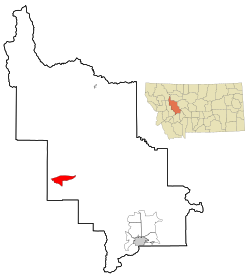
Lincoln is a census-designated place (CDP) in Lewis and Clark County, Montana, United States. As of the 2000 census, the city population was 1,100.
Meriwether Lewis passed through here on his return to St. Louis in 1806, following the famous “River of the Road to the Buffalo” created by Native Americans centuries before. Gold discoveries in the mid-1860s brought miners to a number of camps in the area and Lincoln was eventually created when nearby Lincoln Gulch was abandoned in favor of the town’s present location. Recreational, logging and mining activities along the Blackfoot River in the early 20th century made it a convenient commercial center. Nearby wilderness areas continue to attract visitors and residents.
The Lincoln Community Hall (1918) and The Hotel Lincoln (1914) are listed on the National Register of Historical Places. Lincoln is located on Montana Highway 200 which is the longest route signed as a state highway in the United States, running 706.6 miles (1,137.2 km) from Idaho to North Dakota.
On April 3, 1996, Federal officers arrested Theodore Kaczynski at his remote cabin outside of Lincoln under suspicion of being the "Unabomber", a political terrorist and survivalist who placed pressure-sensitive bombs inside mailed packages. The bombing campaign resulted in three deaths and 23 wounded. Kaczynski is currently serving eight life sentences plus 30 years.
Lincoln is located at 46°57′28″N 112°40′20″W / 46.957713°N 112.672178°W (46.957713, -112.672178). Its elevation is 4536 feet (1382 meters) above sea level. According to the United States Census Bureau, the CDP has a total area of 18.2 square miles (47 km2), of which, 17.9 square miles (46 km2) of it is land and 0.2 square miles (0.52 km2) of it (1.32%) is water.
...
Wikipedia
