Leicestershire, England
| Leicestershire | |||
|---|---|---|---|
| County | |||
|
|||
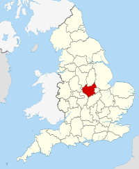
 Leicestershire in England |
|||
| Sovereign state |
|
||
| Country |
|
||
| Region | East Midlands | ||
| Established | Historic | ||
| Ceremonial county | |||
| Area | 2,156 km2 (832 sq mi) | ||
| • Ranked | 28th of 48 | ||
| Population (mid-2016 est.) | 1,031,300 | ||
| • Ranked | 21st of 48 | ||
| Density | 478/km2 (1,240/sq mi) | ||
| Ethnicity | 85.0% White 11.9% S.Asian 1.2% Black British 1.5% Mixed Race |
||
| Non-metropolitan county | |||
| County council | Leicestershire County Council | ||
| Executive | Conservative | ||
| Admin HQ | Glenfield | ||
| Area | 2,083 km2 (804 sq mi) | ||
| • Ranked | 20th of 27 | ||
| Population | 683,000 | ||
| • Ranked | 17th of 27 | ||
| Density | 327/km2 (850/sq mi) | ||
| ISO 3166-2 | GB-LEC | ||
| ONS code | 31 | ||
| NUTS | UKF22 | ||
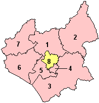
 Districts of Leicestershire |
|||
| Districts | |||
| Members of Parliament | |||
| Time zone | Greenwich Mean Time (UTC) | ||
| • Summer (DST) | British Summer Time (UTC+1) | ||
Leicestershire (/ˈlɛstərʃər/ or /ˈlɛstərʃɪər/; abbreviation Leics.) is a landlocked county in the English Midlands. It takes its name from and is home to at least one third of Greater Leicester at its centre, although the City of Leicester unitary authority is today administered separately from the rest of Leicestershire. The county borders Nottinghamshire to the north, Lincolnshire to the north-east, Rutland to the east, Northamptonshire to the south-east, Warwickshire to the south-west, Staffordshire to the west, and Derbyshire to the north-west. The border with most of Warwickshire is Watling Street (the A5).
The county has a population of just over 1 million with over half the population living in Leicester's built-up area.
...
Wikipedia

