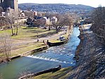
Lehigh Valley, Pennsylvania
|
Lehigh Valley, PA–NJ MSA Allentown–Bethlehem–Easton, PA–NJ Metropolitan Statistical Area |
||||||
|---|---|---|---|---|---|---|
| Eastern Pennsylvania Metropolitan Statistical Area |
||||||
|
||||||
 Map of the Lehigh Valley |
||||||
| Country | United States | |||||
| States |
Pennsylvania - New Jersey |
|||||
| Largest city | Allentown | |||||
| Other cities |
List
|
|||||
| Rank | 64th | |||||
| Area | ||||||
| • Total | 42 sq mi (110 km2) | |||||
| Elevation | 2,180 ft (660 m) | |||||
| Population (2010 Census) | ||||||
| • Total | 821,623 (2,010 Census) | |||||
| Time zone | ET (UTC−5) | |||||
| • Summer (DST) | EDT (UTC−4) | |||||
The Lehigh Valley (/ˈli.haɪ ˈvæ.li/), known officially by the United States Census Bureau and the United States Office of Management and Budget as the Allentown–Bethlehem–Easton, PA–NJ Metropolitan Statistical Area and referred to colloquially as The Valley, is a metropolitan region officially consisting of Carbon, Lehigh and Northampton counties in eastern Pennsylvania and Warren county on the western edge of New Jersey, in the United States. The Lehigh Valley's largest city, with a population of 119,104, is Allentown.
The Lehigh Valley is the fastest growing and third most populous region in the state of Pennsylvania with a population of 821,623 residents as of the 2010 U.S. Census. It is eclipsed in total population only by the metropolitan areas of Philadelphia and Pittsburgh in Pennsylvania. It is the 64th most populated metropolitan area in the United States. Lehigh County, the Valley's largest county in terms of overall population, is among the fastest growing in the nation as well, ranking in the 79th percentile for population growth between 2010–2012. The core population centers are located in southern and central Lehigh and Northampton counties along U.S. Route 22 and Interstate 78.
...
Wikipedia


