Lehigh Township, Northampton County, Pennsylvania
| Lehigh Township | |
| Settlement | |
|
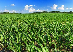
Corn growing in the township
|
|
| Country | United States |
|---|---|
| State | Pennsylvania |
| County | Northampton |
| Elevation | 669 ft (203.9 m) |
| Coordinates | 40°44′59″N 75°32′29″W / 40.74972°N 75.54139°WCoordinates: 40°44′59″N 75°32′29″W / 40.74972°N 75.54139°W |
| Area | 29.9 sq mi (77.4 km2) |
| - land | 29.7 sq mi (77 km2) |
| - water | 0.2 sq mi (1 km2), 0.67% |
| Population | 9,728 (2000) |
| Density | 327.7/sq mi (126.5/km2) |
| Timezone | EST (UTC-5) |
| - summer (DST) | EDT (UTC-4) |
| Area code | 610 |
|
Location of Lehigh Township in Northampton County
|
|
Lehigh Township is a township in Northampton County, Pennsylvania, United States. Lehigh Township is located in the Lehigh Valley region of the state.
The population of Lehigh Township was 10,527 as of the 2010 census.
According to the United States Census Bureau, the township has a total area of 29.9 square miles (77 km2), of which, 29.7 square miles (77 km2) of it is land and 0.2 square miles (0.52 km2) of it (0.80%) is water. It is drained by the Lehigh River, which separates it from Lehigh County and Blue Mountain separates it from Carbon County to the north. Its villages include Berlinsville, Cherryville, Danielsville, Lehigh Gap (also in Lehigh County,) Pennsville, Rockville, and Treichlers.
The township's numbered roads include north-to-south Routes 145 and 873 and east-to-west Routes 248 and 946. 145 and 873 have their northern termini on 248 in Lehigh Gap and extend downriver via Treichlers to Allentown and south via Slatington to Schnecksville, respectively. 248 connects Carbon County with Bath, Nazareth, and Easton, while 946 extends east from 248 in Berlinsville to Klecknersville and Moorestown. Other local roads of note include Blue Mountain Drive, Cherryville Road, Indian Trail Road, and Mountain View Drive.
As of the census of 2000, there were 9,728 people, 3,680 households, and 2,833 families residing in the township. The population density was 327.7 people per square mile (126.5/km2). There were 3,816 housing units at an average density of 128.6/sq mi (49.6/km2). The racial makeup of the township was 98.67% White, 0.36% African American, 0.20% Native American, 0.17% Asian, 0.16% from other races, and 0.43% from two or more races. Hispanic or Latino of any race were 0.74% of the population.
...
Wikipedia


