Lebanon, VA
| Town of Lebanon, Virginia | ||
|---|---|---|
| Town | ||

Downtown Lebanon
|
||
|
||
| Nickname(s): "Heart of Southwest Virginia" | ||
| Motto: "Progressing for the Future" | ||
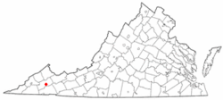
 Location in the Commonwealth of Virginia |
||
| Coordinates: 36°54′3″N 82°4′37″W / 36.90083°N 82.07694°WCoordinates: 36°54′3″N 82°4′37″W / 36.90083°N 82.07694°W | ||
| Country | United States | |
| State | Virginia | |
| County | Russell | |
| Government | ||
| • Mayor | Nelson A.Dodi | |
| Area | ||
| • Total | 4.1 sq mi (10.6 km2) | |
| • Land | 4.1 sq mi (10.6 km2) | |
| • Water | 0.0 sq mi (0.0 km2) | |
| Elevation | 2,060 ft (628 m) | |
| Population (2010) | ||
| • Total | 3,424 | |
| U.S. Census Bureau, 2010 Population Estimates | ||
| Time zone | EST (UTC-5) | |
| • Summer (DST) | EDT (UTC-4) | |
| ZIP code | 24266 | |
| Area code(s) | 276 | |
| FIPS code | 51-44696 | |
| GNIS feature ID | 1498504 | |
| Website | http://www.lebanonva.net/ | |
Lebanon is a town in Russell County, Virginia, United States. The population was 3,424 at the 2010 census. It is the county seat of Russell County.
Carter Hill, Daugherty's Cave and Breeding Site, Stephen B. Quillen House, and Blackford Bridge are listed on the National Register of Historic Places.
Lebanon is located at 36°54′3″N 82°4′37″W / 36.90083°N 82.07694°W (36.900912, -82.076988).
According to the United States Census Bureau, the town has a total area of 4.1 square miles (10.6 km²), all of it land.
As of the census of 2010, there were 3,424 people, 1,507 households, and 884 families residing in the town. The population density was 835.1 people per square mile (323.0/km²). There were 1,681 housing units at an average density of 410.0 per square mile (158.6/km²). The racial makeup of the town was 94.7% White, 2.9% African American, 0.3% Native American, 0.5% from other races, and 0.8% from two or more races. Hispanic or Latino of any race were 1.4% of the population.
...
Wikipedia

