Leasowe Lighthouse
| Leasowe and Moreton East | |
|---|---|
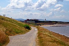
 The pathway along Mockbeggar Wharf, with Leasowe Castle and Leasowe Lighthouse in the distance |
|
| Leasowe and Moreton East shown within Merseyside | |
| Population | 14,640 (2001 Census.Ward) |
| OS grid reference | SJ270914 |
| • London | 182 mi (293 km) SE |
| Metropolitan borough | |
| Metropolitan county | |
| Region | |
| Country | England |
| Sovereign state | United Kingdom |
| Post town | WIRRAL |
| Postcode district | CH46 |
| Dialling code | 0151 |
| ISO 3166 code | GB-WRL |
| Police | Merseyside |
| Fire | Merseyside |
| Ambulance | North West |
| EU Parliament | North West England |
| UK Parliament | |

Leasowe Lighthouse
|
|
| Location | Leasowe Merseyside England |
|---|---|
| Coordinates | 53°24′48″N 3°07′33″W / 53.413215°N 3.125782°W |
| Year first constructed | 1763 |
| Deactivated | 1908 |
| Construction | brick tower |
| Tower shape | cylindrical tower with balcony and lantern removed |
| Markings / pattern | white tower |
| Height | 33.5 metres (110 ft) |
| ARLHS number | ENG-063 |
Leasowe (locally /ˈliːsˌoʊ/) is an area on the north coast of the Wirral Peninsula, in North West England, near Moreton and between Wallasey and Meols. Historically within Cheshire, Leasowe was part of the old County Borough of Wallasey, and is now within the Metropolitan Borough of Wirral, the Wallasey parliamentary constituency and the New Wallasey Regeneration programme. However, it also has its own characteristics and is often regarded as a separate town. At the 2001 Census, Leasowe had a population of 6,180 (2,890 males, 3,290 females). By the time of the 2011 Census figures for Leasowe were no longer maintained. However, there was an electoral ward called Leasowe and Moreton East. The population of the ward at this Census was 14,640.
The name 'Leasowe' comes from the Anglo-Saxon Leasowes or 'Meadow Pastures'. Its sand dunes are the largest such system on the Wirral. Much of the area is at or below sea level and is protected by the coastal embankment. Houses built in the early 20th century were often flooded and unsanitary, but after about 1926 new roads and drainage were put in by the Borough Council, and much new housing was developed. Along the embankment between Leasowe and Moreton are the remains of fortifications built during the Second World War.
...
Wikipedia

