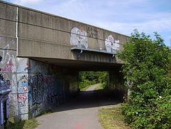
Layerthorpe
| Layerthorpe | |
|---|---|
 Layerthorpe Bridge |
|
| Layerthorpe shown within North Yorkshire | |
| OS grid reference | SE617521 |
| Unitary authority | |
| Ceremonial county | |
| Region | |
| Country | England |
| Sovereign state | United Kingdom |
| Post town | YORK |
| Postcode district | YO31 |
| Police | North Yorkshire |
| Fire | North Yorkshire |
| Ambulance | Yorkshire |
| EU Parliament | Yorkshire and the Humber |
| UK Parliament | |
Layerthorpe is a former village and latterly industrial district to the north-east of the centre of the city of York, North Yorkshire, England. It is just outside the city walls of York.
York historian Francis Drake suggested in his Eboracum (1736) that the first part of the name referred to a resting-place (or "lair") used by deer on the edge of the Forest of Galtres. The second part ("thorpe") is a placename suffix used within the Danelaw for small settlements adjacent to larger ones. The earliest known reference (in a charter of 1184–9) calls the village "Leirthorp".
After William the Conqueror created a dam in the River Foss in 1069 to create a moat around York Castle, the river flooded in the Layerthorpe area, forming a large lake that would become known as the "King's Pool" (or "King's Fishpool"). The King's Pool became an integral part of the city's defences during the Middle Ages – this explains the absence of defensive wall in the area today – and was well known for its abundance of fish.
The fourteenth-century Layerthorpe Bridge, a crossing of the Foss, adjacent to the King's Pool, was once attached to a postern in the city wall, known as Layerthorpe Postern. In 1829, the bridge was rebuilt, and the Postern and a short section of wall were demolished. In 1926, the bridge was widened again, and in the 1990s it was completely rebuilt on a different alignment.
Layerthorpe bridge led to the village of Layerthorpe on the road, now called Layerthorpe, which runs from York to the suburb of Heworth. There was a medieval church (St. Mary's, Layerthorpe), which was built about fifty yards from the bridge in the fourteenth century or earlier. The church was closed in 1549, and the parish was united with that of St. Cuthbert's, Peasholme Green, in 1586. The church has disappeared, although its foundations were temporarily uncovered in 1920.
Meanwhile, the King's Pool declined, as silt from upriver collected and there was not enough water coming down to move it on. In the eighteenth century, the waters were so low that marshy islands had begun to appear, giving the area the additional name of Foss Islands, and during the summer months the river smelled foul and was mostly dry and stagnant. At the end of the eighteenth century, the Foss was canalised and the Pool disappeared. In 1854, the area was drained and Foss Islands Road (now part of the York Inner Ring Road) was constructed between Layerthorpe Bridge and Walmgate Bar.
...
Wikipedia

