Lavezares, Northern Samar
| Lavezares | |
|---|---|
| Municipality | |
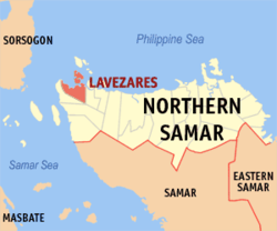
 Map of Northern Samar with Lavezares highlighted |
|
| Location within the Philippines | |
| Coordinates: 12°32′N 124°20′E / 12.533°N 124.333°ECoordinates: 12°32′N 124°20′E / 12.533°N 124.333°E | |
| Country | Philippines |
| Region | Eastern Visayas (Region VIII) |
| Province | Northern Samar |
| Congr. district | District of N. Samar |
| Established | 1875 |
| Barangays | 26 |
| Government | |
| • Mayor | Quintin B. Saludaga |
| • Vice-Mayor | Ricardo Chan |
| Area | |
| • Total | 119.50 km2 (46.14 sq mi) |
| Population (2015) | |
| • Total | 28,770 |
| • Density | 240/km2 (620/sq mi) |
| Time zone | PST (UTC+8) |
| ZIP code | 6404 |
| Dialing code | 55 |
Lavezares is a fourth class municipality in the province of Northern Samar, Philippines. It is bounded on the west by the municipality of Allen, on the north-west by San Bernardino Strait, on the south and south-west by the municipality of Victoria, on the east by the municipality of Rosario and on the north by the municipality of Biri. According to the 2015 census, it has a population of 28,770 people.
Lavezares was just a visita during the late 19th century. In this period of time, Barobaybay, Villa and MacArthur served as the oldest pueblos of the old municipality.
During the Spanish period, Lavezares was controlled by secular piests. It was named in honor of the Spanish Governor-General Guido de Lavezares who helped them become separated from the Municipality of Allen, and be an independent municipality. Sitios of Lavezares including Caburihan, Ocad, Caragas, Cataogan and Sabang-Tabok were converted into barangays though Republic Act 2370 (the Barrio Charter Act) and Republic Act 3590 (the Revised Barrio Charter Act). And shortly, the municipality was administered by the capitanes, presidentes and municipal mayors.
Lavezares has a land area of 11,950 hectares (29,500 acres), with a topography that is generally characterized by very rugged terrain with many steep and elevated areas classified as undulating to hilly. Technically, there are only two hills in the area, these are located in the southernmost part of Barangays Chansvilla and Toog. No mountain can be found in the area.
There are also no major plains but a few flat lands that not very extensive. The coastal areas of Lavezares are limited and have generally moderately terrain. Bacolods which serve as natural breakwater on different coasts of the municipality can be found along the coasts of Barangays Balicuatro, Villa, Bani and Magsaysay among others. They are protected as part of the Biri Larosa Protected Landscape and Seascape.
...
Wikipedia

