Laramie Regional Airport
| Laramie Regional Airport | |||||||||||||||
|---|---|---|---|---|---|---|---|---|---|---|---|---|---|---|---|
 |
|||||||||||||||
| Summary | |||||||||||||||
| Airport type | Public | ||||||||||||||
| Owner | Laramie Regional Airport Board | ||||||||||||||
| Serves | Laramie, Wyoming | ||||||||||||||
| Elevation AMSL | 7,284 ft / 2,220 m | ||||||||||||||
| Coordinates | 41°18′43″N 105°40′30″W / 41.31194°N 105.67500°WCoordinates: 41°18′43″N 105°40′30″W / 41.31194°N 105.67500°W | ||||||||||||||
| Website | laramieairport.com | ||||||||||||||
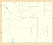
| Map | |||||||||||||||
| Location of airport in Wyoming / United States | |||||||||||||||
| Runways | |||||||||||||||
|
|||||||||||||||
| Statistics (2010) | |||||||||||||||
|
|||||||||||||||
|
Source: Federal Aviation Administration
|
|||||||||||||||
| Aircraft operations | 11,762 |
|---|---|
| Based aircraft | 39 |
Laramie Regional Airport (IATA: LAR, ICAO: KLAR, FAA LID: LAR) is three miles west of Laramie, in Albany County, Wyoming. It is owned by the Laramie Regional Airport Board. Airline service is subsidized by the Essential Air Service program.
Federal Aviation Administration records say the airport had 10,371 passenger boardings (enplanements) in calendar year 2008, 8,663 enplanements in 2009, and 8,999 in 2010. The National Plan of Integrated Airport Systems for 2011–2015 categorized it as a primary commercial service airport based on enplanements in 2008 (more than 10,000 per year).
The area has many businesses and the University of Wyoming and the Wyoming Technical Institute. The airport has airline flights to Denver, Colorado, but these are less than one percent of all flights. The airport has an important fire fighting role.
Built in 1934, the airport was Brees Field until 1992, after United States Army general Herbert J. Brees. To allow B-24 Bombers the runways were paved in 1944. Airline flights started in 1945; in 1959 the terminal building was built.
...
Wikipedia


