Land Between The Lakes National Recreation Area
| Land Between the Lakes National Recreation Area | |
|---|---|
|
IUCN category V (protected landscape/seascape)
|
|

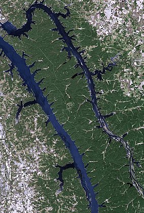
Satellite photography
|
|
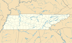
| Location | Lyon and Trigg counties in Kentucky and Stewart County in Tennessee, USA |
| Nearest city | Paducah, Kentucky |
| Coordinates | 36°51′25″N 88°04′29″W / 36.85694°N 88.07472°WCoordinates: 36°51′25″N 88°04′29″W / 36.85694°N 88.07472°W |
| Area | roughly 170,000 acres (688 km2) |
| Established | 1963 |
| Governing body | United States Forest Service |
| Website | Land Between the Lakes National Recreation Area |
The Land Between the Lakes National Recreation Area is a United States National Recreation Area located in Kentucky and Tennessee between Lake Barkley and Kentucky Lake. The area was designated a national recreation area by President John F. Kennedy in 1963. The recreation area was originally managed by the Tennessee Valley Authority but jurisdiction has since been transferred to the United States Forest Service. It was designated as a UNESCO Biosphere reserve in 1991.
The Tennessee and Cumberland Rivers flow very close to each other in the northwestern corner of Middle Tennessee and Western Kentucky, separated by a rather narrow and mostly low ridge. The area of land that separates the two bodies of water by only a few miles became known as "Between the Rivers" since at least the 1830s or 1840s. After the Cumberland River was impounded in the 1960s and a canal was constructed between the two lakes, Land Between the Lakes became the largest inland peninsula in the United States. Downstream from this area, the courses of the two rivers diverge again, with the mouth of the Cumberland emptying into the Ohio River approximately 4 mi (7 km) from that of the Tennessee.
Government first began to have a major impact on the area when the Confederate government built Fort Henry on the banks of the Tennessee, ostensibly to protect the upper reaches of that river from Union gunboats; initially, Kentucky had declared its neutrality in the American Civil War. When Fort Henry fell in early 1862, there was little more Civil War action in the area, which was judged to be too devoid of valuable war resources to deserve much attention from either side, and it went back to its somewhat isolated ways. The next major event in the area, other than calls for men to fight in the Spanish–American War and World War I, was the formation of the Tennessee Valley Authority as part of President Franklin Delano Roosevelt's New Deal. The site of the last dam downstream on the Tennessee was to be Gilbertsville, Kentucky. The resulting impoundment, completed in the early 1940s, Kentucky Lake, flooded some of the low-lying land on the western side of the area, resulting in the condemnation of land and the forced removal of some area farmers. This was very unpopular with some of those affected, while others seemed happy to get an opportunity to sell their land and start a new life in a less remote area.
...
Wikipedia


