Lalmonirhat District
|
Lalmonirhat লালমনিরহাট |
|
|---|---|
| District | |
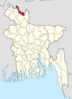
 Location of Lalmonirhat in Bangladesh |
|
| Coordinates: 26°00′N 89°15′E / 26.00°N 89.25°ECoordinates: 26°00′N 89°15′E / 26.00°N 89.25°E | |
| Country |
|
| Division | Rangpur Division |
| Area | |
| • Total | 1,247.37 km2 (481.61 sq mi) |
| Population (2011 census) | |
| • Total | 1,256,099 |
| • Density | 1,000/km2 (2,600/sq mi) |
| Time zone | BST (UTC+6) |
Lalmonirhat (Bengali: লালমনিরহাট জেলা, Lalmonirhat Jela also Lalmonirhat Zila) is a district, situated at the northern border of Bangladesh. It is a part of the Rangpur Division. Lalmonirhat includes 5 upazilas. They are Patgram, Hatibandha, Aditmari, Kaliganj and Lalmonirhat Sadar. Among them Hatibandha is largest and Aditmari is smallest. Lalmonirhat was a part of sector-6 during the liberation war. The main rivers are: Tista, Dharla, Rotnai
Education: Lalmonirhat has 27 colleges, 200 secondary schools, 597 primary schools and 269 madrasas. Lalmonirhat is one of the 7 illiteracy free districts in Bangladesh.
Main Professions: Agriculture is the major income source. 72.78% people are farmers, 10.49% are businessmen, 3.46% are labours, 4.45% are employees.
Tourist Spots & Historical Places: Lalmonirhat airport, Military firm (Anandalok Park), Sheikh Russel children's park, Mogolhat zero point, Burimari landport, Tista bridge, Tista barrage, Shalbon, House of Kabi Sheikh Fazlal Karim, Tushvandar Zamindar Palace, Tin Begha Koridor etc.
Sources: Census 2011 Census 2001,Bangladesh Bureau of Statistics (BBS),
...
Wikipedia
