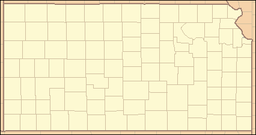
Lake Scott State Park
| Lake Scott State Park | |
| Kansas State Park | |
|
El Cuartelejo pueblo ruins
|
|
| Named for: Lake Scott | |
| Country | United States |
|---|---|
| State | Kansas |
| Counties | Scott County |
| Location | Scott City |
| - elevation | 2,831 ft (863 m) |
| - coordinates | 38°40′32″N 100°55′00″W / 38.67556°N 100.91667°WCoordinates: 38°40′32″N 100°55′00″W / 38.67556°N 100.91667°W |
| Area | 1,280 acres (518 ha) |
| Founded | 1928 |
| Management | Kansas Wildlife and Parks |
| Visitation | 150,000 |
| Website: Lake Scott State Park | |
Lake Scott State Park is a 1,280-acre (520 ha) Kansas state park in Scott County, Kansas in the United States. The park was established in 1928 following a donation of the land by the Herbert Steele family. The park, also known as Scott State Park, surrounds Lake Scott, a spring-fed freshwater lake. Lake Scott State Park is between Oakley and Scott City, about one mile west of U.S. Route 83. The park is open for year-round recreation including camping, hunting, fishing, hiking, boating and picnicking. Lake Scott State Park is home to the only known Indian pueblo in Kansas, El Cuartelejo.
Lake Scott State Park is the site of a ruined Taos Pueblo. The Taos arrived in western Kansas in 1664. After having escaped the Spanish colonial rule in New Mexico. They formed an alliance with a group of Plains Apache. The Taos Indians built the protective pueblos and an irrigation system from a nearby spring to water their crops. The settlement, known as El Cuartelejo, was occupied for 20 years before the builders returned to their home territory. The pueblo was reoccupied in 1696 by a group of Picuri Indians. The Picuris were compelled to retreat to their homelands in colonial New Mexico ten years later.
The Picuri were the last Native Americans to occupy the pueblo. A Spanish expedition used the pueblo in 1720 on a journey to the north and west to determine the strength of the French in the area. The expeditionary forces were attacked by a group of Pawnee about 150 miles (240 km) from El Cuartelejo. The Spanish considered using the structure as a frontier station, but cancelled the undertaking due to its remote location from their supplies in New Mexico. The last know settlement at the pueblo was recorded in 1727 when local Indians reported that it was being used by French traders. The effects of weather and erosion caused the structure to disappear, leaving just a "slight mound" and some irrigation ditches.
...
Wikipedia


