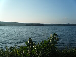
Lake Pocotopaug
| Lake Pocotopaug | |
|---|---|
| Census-designated place | |

Lake Pocotopaug
|
|
| Coordinates: 41°35′54″N 72°30′37″W / 41.59833°N 72.51028°WCoordinates: 41°35′54″N 72°30′37″W / 41.59833°N 72.51028°W | |
| Country | USA |
| State | Connecticut |
| County | Middlesex County |
| Town | East Hampton |
| Area | |
| • Total | 9 km2 (3 sq mi) |
| • Land | 6.9 km2 (2.7 sq mi) |
| • Water | 2.1 km2 (0.8 sq mi) |
| Population (2000) | |
| • Total | 3,169 |
| • Density | 456.6/km2 (1,183/sq mi) |
Lake Pocotopaug is a village and census-designated place (CDP) in the Town of East Hampton in Middlesex County, Connecticut, United States.
It is named for the large local lake, which for years has been a popular resort area. The lake is surrounded by numerous homes. Most are year-round residences, although some summer cottages dot the shore. It is especially noted for two islands in its center, separated by a narrow, shallow strait (both of which have cabins).
The lake's name reportedly comes from the local Wangunk Indian language for "lake with pierced islands" or "divided pond." According to local legend, some time long before the area was settled by whites, the tribe living there felt they were being cursed by their irritable Great Spirit. To try to appease him, the main chief agreed to sacrifice his daughter, who willingly threw herself into the lake and drowned. The tribe's shamans announced that never again would an Indian be killed on the lake.
Lake Pocotopaug, at 512 acres, is large, but many other lakes in Connecticut are larger. The largest by far, is Candlewood Lake at 5064 acres.
The Wangunk were also said to have hunted on Spellman's point, a quaint street lined with cottages, using loud noises to scare the animals to the end of the peninsula, and thereby an effective way to gather food, however in the mid-to-late 1800s it was sold for a sack of bean to the "Bay point" society.
Sears Park is located at the lake and has various swimming, boating and recreational facilities for residents.
In recent years the lake has become a place of ecological study due to the large scale algae blooms that resulted in 2000. Tests have shown that longstanding shoreline development and fertilizer use are causing increasing issues. A town sanctioned Lake Commission and the Friends of Lake Pocotopaug are two organizations concentrating on improvement ideas.
According to the United States Census Bureau, the CDP has a total area of 9.0 km² (3.5 mi²). 6.9 km² (2.7 mi²) of it is land and 2.1 km² (0.8 mi²) of it (23.28%) is water.
As of the census of 2000, there were 3,169 people, 1,347 households, and 844 families residing in the CDP. The population density was 456.6/km² (1,183.9/mi²). There were 1,532 housing units at an average density of 220.7/km² (572.3/mi²). The racial makeup of the CDP was 96.81% White, 0.95% African American, 0.35% Native American, 0.92% Asian, 0.03% Pacific Islander, 0.03% from other races, and 0.92% from two or more races. Hispanic or Latino of any race were 1.01% of the population.
...
Wikipedia
