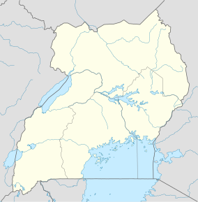
Lake Opeta
| Lake Opeta | |
|---|---|
| Location | Nakapiripirit, Sironko, Katakwi, Kumi |
| Coordinates | 1°42′0″N 34°14′0″E / 1.70000°N 34.23333°E |
| Primary outflows | Lake Bisina |
| Basin countries | Uganda |
| Surface area | 68,912 hectares (170,290 acres) |
| Surface elevation | 1,962 metres (6,437 ft) |
| Islands | Tisai |
| Designated | September 15, 2006 |
| Lake Opeta | |
|---|---|
| Coordinates | 01°42′N 34°14′E / 1.700°N 34.233°ECoordinates: 01°42′N 34°14′E / 1.700°N 34.233°E |
| Area | 68,912 hectares (170,290 acres) |
| Established | 2006 |
| Governing body | District Government |
Lake Opeta is a lake with an extensive wetland system in Uganda.
The wetland lies south of the Pian Upe Wildlife Reserve and serves as a dry-season refuge for both wildlife from the park and domestic cattle of the surrounding Karamajong and Pokot people.
Lake Opeta is primarily fed by rainfall on Mount Elgon and drains into Lake Kyoga via Lake Bisina. It is surrounded by an extensive swamp and floodplain.
Lake Opeta is one of Uganda's 33 Important Bird Areas and since 2006 a Ramsar-listed wetland of international importance.
A Biodiversity and Eco-Tourism Centre funded by the Global Environmental Facility and UNDP serves the lake.
Fox's weaver, Uganda's only endemic bird species, is known to inhabit the wetland, as do the globally threatened vulnerable shoebill, near-threatened papyrus gonolek, and 160 other species.
...
Wikipedia

