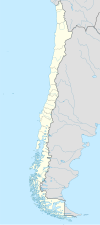
Lago Ranco, Chile
| Lago Ranco | |||||
|---|---|---|---|---|---|
| Town and Commune | |||||
 |
|||||
|
|||||
| Coordinates (town): 40°19′S 72°30′W / 40.317°S 72.500°WCoordinates: 40°19′S 72°30′W / 40.317°S 72.500°W | |||||
| Country | Chile | ||||
| Region | Los Ríos | ||||
| Province | Ranco | ||||
| Lago Ranco | 14 February 1941 | ||||
| Government | |||||
| • Type | Municipality | ||||
| • Alcalde | Santiago Rosas Lobos (PDC) | ||||
| Area | |||||
| • Total | 1,763.3 km2 (680.8 sq mi) | ||||
| Elevation | 64 m (210 ft) | ||||
| Population (2012 Census) | |||||
| • Total | 9,575 | ||||
| • Density | 5.4/km2 (14/sq mi) | ||||
| • Urban | 2,205 | ||||
| • Rural | 7,893 | ||||
| Sex | |||||
| • Men | 5,295 | ||||
| • Women | 4,803 | ||||
| Time zone | CLT (UTC-4) | ||||
| • Summer (DST) | CLST (UTC-3) | ||||
| Area code(s) | 56 + 63 | ||||
| Website | Municipality of Lago Ranco | ||||
Lago Ranco is a town and commune in southern Chile administered by the Municipality of Lago Ranco. It is located in Ranco Province in Los Ríos Region. Lago Ranco takes name from Ranco Lake that it shares with the commune of Futrono.
Ranco Lake Basin was inhabited since ancient times by indigenous people belonging to Huilliche "people of the south", which was characterized by a more peaceful than that of the Mapuche. Although this was not the norm, as demonstrated in the great rebellion led by toqui Pelantaru in 1599 and that meant the destruction and abandonment of cities and fountains built by the Spanish conquistadors south of the Bío-Bío. But most of the life of the Huilliche communities in the area, spent a relatively quiet in close contact with the natural environment that gave them their livelihood: the gathering, hunting, fishing, livestock and incipient agriculture, were the activities that allowed him to maintain their sedentary lifestyle and the development of certain cultural expressions. During the colonial period this picture changed little, remaining outside the territories of the colonization process, only rarely are noticed some attempts to integrate this area to civilized life, for example, through missionary work of the Jesuits from the fortifications of Quinchilca in the north, and San José de Alcudia, on the south, on the banks of the river Well, west of the lake. The geographical setting in which they lived Huilliches communities in our area were Maihue lacustrine basins and Ranco, both lakes located in the pre-Andean area and connected by the river Calcurrupe. In this geographical setting that had its genesis in the last glacial period, the Quaternary-lived the early inhabitants of this place, and each sector was taking a name that identifies you to present: Maihue, Curriñe, Chabranco, hueinahue and Rupumeica, Cars in Maihue sector. TRINGL, Ranco, Huapi, Calcurrupe, Llifén, Illahuapi, Pocuro, Riñinahue, Pitreño, Ilihue, Quillaico, Ignatieff, Pitriuco in the area of Lago Ranco.
During the Republican era in the nineteenth and twentieth centuries, the Chilean state must promote a process of settlement and integration of their individual territories, the national life. But its location in the pre-Andean sector the Lake Ranco was not an objective considered in this process whose attention was focused on the longitudinal valley and the coastal sector. Still, in 1846 the cartographer Bernardo Phillippi, drew up a map of the province of Valdivia, made at the time by the departments of Valdivia and Osorno. Another nineteenth-century historical record indicates that in 1885 the Department of Valdivia was divided into sub-delegations and districts, such as sub No. 8 of Quinchilca was established, which included the districts of Quinchilca, Riñihue and Maihue. The latter is the land area basis for future community of Lago Ranco. The first colonists who settled on the banks of Lake Ranco, arrived from the late nineteenth century, which motivated his adventurous spirit took up residence in the western sector of the Lake, in the areas of Hueimen and Ignatieff, natural beauty and the immense wealth of native forests was a major reason why families continue to arrive by German colonists, who formed the vanguard of settlement in this place and encouraged the integration with the central valley. Among these early families were Konust, Daniel and Rettig, whose descendants still develop the entrepreneurial spirit of their ancestors. On the other hand, you should also mention other families from these places whose descendants represents the link with the ancestral past. These families may include: Ancacura, Huaito, Huenuman, Quichel, NEIP, Antilaf, Calfulef, Millape, Curinao, Calfumil, Catrihual and others, which are an example of the historical heritage of the ancestors Huilliches.
...
Wikipedia


