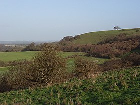
Ladle Hill
| Ladle Hill | |
|---|---|

Looking northeast towards Ladle Hill
|
|
| Highest point | |
| Elevation | 232 m (761 ft) |
| Coordinates | 51°18′31″N 1°18′54″W / 51.3087°N 1.3149°WCoordinates: 51°18′31″N 1°18′54″W / 51.3087°N 1.3149°W |
| Geography | |
| Location | Hampshire, England |
| OS grid | SU478568 |
| Topo map | OS Landranger 174 |
| Climbing | |
| Easiest route | Wayfarer's Walk |
Ladle Hill lies on Great Litchfield Down, near the village of Burghclere and Watership Down, in north Hampshire. It is immediately to the east of Beacon Hill. Part of the hill is a 10.37 hectares (25.6 acres) biological SSSI, number 1000642, first notified in 1978. It is 232 metres high and has a hillfort and a tumulus on its slopes. The hill is easily accessed from the nearby cross county footpath, Wayfarer's Walk. The hill falls within the North Wessex Downs Area of Outstanding Natural Beauty.
The hillfort on the top of the hill has never been excavated, but the land and ditch are sharply defined and well preserved. This Iron Age fort is roughly rectangular and enclosed seven acres within an embankment and ditch. There are two probable entrances to the east and west. The work seems to have been undertaken by several different labour forces, each working on a section of the defences, but for some reason the task was abandoned and the fort left unfinished. A 170 ft diameter disc barrow lies just to the north (scheduled ancient monument number 43), and there are several other barrows in the area, mostly ploughed-out.
Ladle Hill is perhaps the best known of all of the unfinished hillforts in Britain (Feacham 1971). It was first correctly identified as an unfinished hillfort and described in detail by the archaeologist Stuart Piggott in 1931. The site has been invaluable to help archeologists understand the methods employed in the creation of Iron Age date univallate enclosures, with the partially constructed nature of the site revealing features that would normally be concealed in a completed example, such as for possible setting-out ditches, and piles of chalky soil initially quarried from the ditch and deposited in the interior for finishing the rampart.
At Ladle Hill it has long been suspected that the area demarcated by the unfinished earthworks never actually contained a settlement, although there is a possibility that the hillfort was to be constructed over an earlier unenclosed settlement. Magnetometer surveys from 1997 shows none of the variation normally associated with former occupation sites on chalk geology, and this would seem to confirm that a settlement with typical Iron Age characteristics, such as storage pits, was never established within the boundary of the earthwork.
...
Wikipedia

